Bodmin Moor Walks
INTRODUCTORY FEATURES This page contains 28 round walks on and around the Moor, all researched between 2010 and 2012. Mostly from 5 to 10 miles in length, they contain Description, Diary, Interest, Statistics, Useful Info and a PDF file of Route Directions, with a few grid references to help locate significant features. Walks are grouped under area. In some cases, two walks can be joined to make one long one.
Glossary of Terminology and Abbreviations
THE WALKS ***** Many other walks are described briefly on my main Bodmin Moor page
And one of the great Bodmin Moor hill walks, a Five Hills Walk from Bowithick
Most visitors to Cornwall drive straight across Bodmin Moor on their way to their beach and surf resorts and give it scarcely a second thought. Even the fitter visitors, planning to walk, are probably thinking only of the Coast Path. They don't know what they are missing and I'm glad of that as it leaves the delights of the moor to the few who know it and love its wildness, its scattered settlements, its pleasing villages, its clapper bridges, its ancient rugged beauty and, most of all, its great range of antiquities. Here are a few of our moorland highlights.
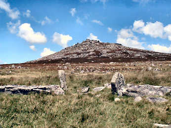
Hills: Brown Willy (1375') and Rough Tor (1325') are the highest and are musts, even though relatively popular. Stowe's Hill is also popular but is definitely a must particularly for its renowned Cheesewring rock column. My favourite hills include rocky Kilmar Tor and Hawke's Tor and remote feeling Buttern Hill and High Moor. Anywhere above about 1000' you get long views and that 'top of the world' feeling.
Rivers: Between them the Fowey, Camel and De Lank rivers drain much of the moor; all rise in the north. The Fowey is the most scenic; you should not miss Golitha Falls, hidden in beech woods. To the east are the Lynher and the Tamar, the latter the boundary with Devon. Antiquities: Easily accessible are the Hurlers and Pipers standing stones, Trethevy Quoit and King Doniert's Stones. Less accessible are the Stripple Stones and Nine Stones circles and King Arthur's Hall. All over the hills are remains of prehistoric settlements and abandoned medieval villages and even abandoned Victorian farmsteads.
Industry: Superb copper mine relics and mineral tramways near Minions village; china clay pits at Stannon, Glynn Valley and Whitebarrow; and a working granite quarry at De Lank between Blisland and St. Breward.
Walking: It's wonderful. See Walking Bodmin Moor for a few words of advice.
Trails: Mark Camp's enjoyable Copper Trail circumnavigates the moor but is not yet waymarked. The Land's End Trail crosses the moor from St. Breward to Caradon Hill.
Villages: Our favourites are St. Neot, Altarnun and Blisland
Pubs: We particularly like the Old Inn in St. Breward, the London Inn in St. Neot and the Crow's Nest
Recommended: "Best of Bodmin Moor" and Mark Camp's Walkaboutwest
Most walkers on Bodmin Moor are there for the solitude and the wonderful scenery. It would probably never occur to the casual walker on the moor that it was formerly, since prehistoric times, a positive hive of industry. Yet you do not have to look far for the evidence of three major industries, two defunct, one still in existence in a minor way. Major industry was mining for tin and copper, an activity that lasted on the moor from the bronze age through to the early 20th century. You can see evidence of early tin streaming on such hills as Buttern Hill and Leskernick Hill, both accessible from Bowithick. Modern era mining is best evidenced around Minions and the slopes of Caradon Hill. In the 19th and 20th centuries the china clay industry flourished on the moor, more than 20 pits having once operated. All pits are now closed but the best sites to see are Stannon Pit, best viewed from the heights of Roughtor, and Glynn Valley which you can access from the car park by the A30 near Temple. Granite is the one major industry that is still active on the moor. At different times there have been around 25 quarries on the moor, now only De Lank Quarry remains of the major quarries; you can walk right through it on a path between Pendrift and St. Breward. Also worth seeing is the defunct Cheesewring quarry below Stowe's Hill near Minions, nowadays the preserve of rock climbers.
Water-filled pit and 3 'alps' at Glynn Valley Works
Other evidence of these industries can be found. Most obvious is the Camel Trail, an 18 mile multi-use trail, once a railway carrying granite and china clay from the moor to the ports of Wadebridge and Padstow. High on the moor you can find former railways and tramways that carried tin, copper and granite. Best of these can be found around Minions and Caradon Hill, obvious from their relative straightness and the granite setts which remain in place. Best examples run from Minions, one to Cheesewring quarry at Stowe's Hill, one from Minions to Kilmar Tor by Wardbrook Farm, one from Minions to Crow's Nest (good pub), and one running round the north and east side of Caradon Hill.
Walking Bodmin Moor - a few words of advice
This is a very different sort of countryside to walk in. The Cornish Coast Path is totally straightforward, well waymarked and impossible to miss. Bodmin Moor is a very different matter. Away from the Open Access land, OS map 109 shows many footpaths. On the ground these are less easy to find, very few signed from roads as they are supposed to be. Some are overgrown, others may have been blocked by landowners, intentionally or otherwise. In places the only way you are sure you are on a path is if you can find the stile into the next field! The OS is supposed to show marsh as blue tufts; it doesn't always and much archaeological information is missing. The only route you can be sure of is Mark Camp's well described - but un-waymarked - Copper Trail around the moor's periphery. So, plan your walk carefully using OS Explorer 109. Take a compass, count field boundaries, be patient and, unless you want to trespass, be prepared to retrace your steps and try once more. If in doubt, ask a farmer, if you can find one. Most importantly, use Cornwall Council's Mapping web site to find Open Access land. But beware, on the Moor a lot of open access land fails to link with other such areas. If, like me, you enjoy antiquities, there are many more than shown on the map. If you enjoy high moorland, remote farms, cattle, native ponies and sheep, you will love Bodmin Moor.
WALKABOUT WEST Mark Camp offers guided walks generally in Cornwall and especially on Bodmin Moor. Mark is one of the experts on Bodmin Moor: its history, its antiquities and its industries - tin and copper mining, granite quarrying and china clay production. Mark has also published a number of books about Bodmin Moor - three books of Short Walks, a new Introductory Guide and a guide to the trail that he devised, the 60 mile Copper Trail around the moor. I walked the Copper Trail in winter 2006. It was a very wet winter so I met up with an awful lot of mud along the way. Even so, it made for a very enjoyable few days, thanks to Mark's careful route directions and detailed maps and informative descriptions of all the interest to be found along the way. One way or another I have done most of Mark's Short Walks, sometimes with walks of my own devising that coincide roughly with Mark's. The odd one, such as the one from North Hill, is tougher than you might expect but all are enjoyable. And I have particularly enjoyed Mark's March 2009 "Introduction to Bodmin Moor."
Online Mapping - Cornwall Council's Mapping Website
The recently introduced 'Right to Roam' legislation - long agitated for by the Ramblers Association, and initially opposed by many landowners - has resulted in vast areas of land all over England, Scotland, Wales and Cornwall being opened up to the general public. Essentially these rights are for walkers only - suits me. I used to find the Countryside Agency's Open Access website an immense help in my Cornwall moorland walking, not just on Bodmin Moor but also in West Penwith. Unfortunately the site, now Natural England, has been messed around with and although the maximum scale is acceptable, maps are too small and navigation is quite awkward. As a result, it is no longer worth, as a walker, using it in its current CRoW Access form. Fortunately, Cornwall Council has an excellent mapping web site, which I find better than the Open Access site ever was. It is easy to use, shows Open Access land, rights of way, path numbers should you wish to report problems, and is zoomable up to large scale. A word of warning on Open Access land. I soon discovered that this may not be quite as straightforward as that. I have encountered barbed wire fences, locked gates and even one gate on Bodmin Moor, leading to access land, that has a 'no walkers' sign on it. And, in West Penwith, where moorland is lower, I have often found impenetrable furze and bramble. So don't expect it to be easy.
OS Explorer maps now show Open Access land as yellow
Ordnance Survey Maps - The 1:25000 Landranger Series
My earliest walking was done with Jane with the Independent Ramblers, based in Ealing. With them we learned to love the Chilterns and the Cotswolds. But we soon graduated to our own independent walks, first from walk books, later of our own devising. The Ordnance Survey 1:25000 series became our bible. The current 2005 Explorer series still is my bible (to a degree) particularly as it now shows Open Access land. But, as with the Bible, you learn not to believe every word. I use OS maps, GPS and compass on most walks, especially on Bodmin Moor and on the moors of West Penwith. But I have lost some trust in OS. Since completing Mark Camp's Copper Trail during winter 2006, I have walked many routes of my own devising on and around Bodmin Moor and have been horrified to discover just how unreliable the Ordnance Survey can be. In my 2011 research walks I have found many paths completely blocked off, others with no FP sign where they leave the road. Below Garrow Tor the OS fails to show a total of five footbridges over the De Lank River; in fairness, even Cornwall Council's Mapping Web Site only shows threee of them. At Smith's Moor, continuous Open Access land turns out to be divided by impenetrable barbed wire. Elsewhere I have found marsh that isn't shown, probably because it is not low-lying. So be advised, take map, GPS and compass and expect the unexpected.
Don't expect all antiquities to be marked either
I hope my Route Directions, contained in separate easily printable PDF files, will be clear. I have divided them first into short sections with a distance for each section. Each section is then divided into short paragraphs with the cumulative distance at the end of each. Some text is in italics, this is usually just a comment or description, often of views. Occasionally I offer detours or alternative routes: these, too, are often in italics. While it is very tempting to include all the GPS data that I record when researching walks, I have restricted myself to using grid references to identify the location of particular points of interest, particularly antiquities which can be obscured by rampant furze and bracken. I have also included the occasional spot height where it may be of significance. I try to include all footpath signs and waymarks and to note where these should be but are missing or damaged. All gates and stiles are included, both usually indicating the nature of the gate or stile. You will find information on stiles under Terminology below and a separate Feature on Cornish Stiles. Abbreviations are explained in a box below as are things special to Cornwall. If you are checking distances as you go along, don't expect mine to be precise; I have a tendency to wander off course to take photographs or to improve a view. There are no maps at present but, in due course, I hope to include sketch maps in the PDF files; in the meantime, the route should be clearly identifiable on Ordnance Survey Explorer sheet 109.
Those who are strangers to walking in Cornwall may be surprised by how the terminology for features in the walker's landscape can differ from normal English usage. Here I list some of the features that may be described differently in Cornwall.
Hedge: In Cornwall this is a battered earth bank, revetted with stone, and with vegetation, or even with shrubs and trees growing on it. A young Cornish Hedge may look much like a drystone wall. There are some English type hedges; when I remember, I describe these as hedgerows. Cairn: Used in Cornwall to describe a Neolithic or Bronze Age burial mound, usually of rocks but often now grass covered. Maps may describe them as barrow or tumulus. Cist: Small coffin-shaped prehistoric burial chamber of stone, often found in cairns but sometimes alone. Clapper Bridge: Rough stone piers, large flat stones laid across. Best known example is at Postbridge on Dartmoor but there are probably more in Cornwall than anywhere else. Most impressive Cornish examples are Bradford Bridge and Delford Bridge on Bodmin Moor, both now used by road traffic. Furze: The customary Cornish term for gorse. In places this can be more than head height and quite impenetrable. Quoit: Also known as a Portal Dolmen. Exposed prehistoric burial chamber, with upright stones and a capstone. Not to be confused with Quite (Cornish Cuyt) which is a wood. Stiles: Proper Cornish stiles are of stone, usually granite or slate. See feature on Cornish Stiles for more information. Round: Circular embanked enclosure. The term seems to be applied rather indiscriminately to both iron age farmstead sites, where there will be a ditch outside, and Plen-a-Gwarys, 'Playing Places' where the Cornish Ordinalia was performed.
I hope these will be either familiar or obvious. CP: Car parking. L: Left. R: Right. T: T junction. FB: Footbridge.
FP: Footpath (sign). LH: Left-hand. RH: Right-hand. WM: Way-mark. X: Cross (roads). NT: National Trust.
Disappointingly, many visitors to Cornwall never get to see a proper Cornish stile. They walk the coast path, much owned by the National Trust which believes in wooden stiles or kissing gates, both very English devices for providing pedestrian access while keeping animals in their field. Or they cycle the official trails and never see a stile. I suppose it is a matter of cost; it must be cheaper to make a wooden gate or stile than laboriously and skilfully set stone cross-pieces into a Cornish hedge. A shame, because the granite or slate stile, in all its forms, expresses the character and landscape of Cornwall where a few bits of wood never can. There are three basic Cornish stile types: the open-stepped cattle stile, the sheep stile with its projecting stones in a widely spaced ladder, and the coffen stile, its stones laid across a pit in the ground. You will also find many variations, including combined coffen/cattle stiles and simple step stiles. Around Bodmin Moor there are few stiles on the Open Access land. However, many of these walks include farmland where you will find a considerable mix of wooden and granite stiles. Thanks to small fields some walks include a lot of stiles, many in a poor state. To learn more about stiles (and hedges) go to Robin Meneer’s excellent Cornish Hedges web site.
Cattle stile and cross near St. Buryan in West Penwith
*************************************************************************
*************************************************************************
Walks from Minions, highest village on the moor
In several cases two of these walks can be linked to make one longer walk
Over Stowe's Hill to Wardbrook, returning on the former Kilmar Tramway
By Tramway to Crow's Nest, back by South Caradon Mine and Caradon Hill Tramway
Crow's Nest, Trethevy Quoit, St. Cleer, King Doniert's Stones, Common Moor
Newlands, Henwood, Bearah Tor, Sharp Tor, Stowe’s Hill
Goldiggings, Craddock Moor, Tregarrick Tor, Siblyback Lake: extensions to 10 miles)
Minions 01 - Over Stowe’s Hill to Wardbrook, returning on the Kilmar Tramway – 3.78 miles
Standing Stones, Stone Circles, Mine Remains, Quarries, Rock Formations and a Tramway
Easily combined with Minions Walk 2, Caradon Hill, for an easy figure-of-eight walk of 8 miles. I suggest doing Walk 01 first, then Walk 02 arriving at the excellent Crow's Nest at lunchtime.
This may be the easiest of all walks from Minions. Not only is it less than four miles, it only has one climb of note, the final rocky 150 feet to the summit of Stowe’s Hill. However, because the walk is designed to include many of the antiquities and points of interest just to the north of Minions village, it is not completely straightforward. In the first mile or so it does a couple of zig-zags to include these. Starting from the western of two car parks in Minions, you first head NNW to find the Pipers standing stones, then back across to the Hurler’s stone circles and on east to Houseman’s Engine House for a good introductory exhibition to the area and its history. Now the walk proper starts and you may find a compass useful here as you cannot see your next objective. About 5 degrees west of north will take you to the famous Rillaton Barrow, where your next objectives become clear. These are Stowe’s Hill, with the famous Cheesewring visible on top but first Daniel Gumb’s Cave below it. On the way you encounter a large disturbed cairn and a massive un-mapped ditch. The climb up Stowe’s Hill is steep and rocky but worth it for the panoramic views. The rest of the walk is completely straightforward: west down into the valley, north towards Sharp Tor and finally south along the Kilmar tramway back to Minions.
Oliver's Diary - Interest - Statistics - Directions & Info
Minions 01 - Stowe's Hill - Oliver'sDiary
I have done this, and related walks, so many times that I feel I could almost do it blindfold. As with Walk 2, Caradon Hill, I first did it with Jane. It was then that we learned about the Mineral Tramways, a knowledge that invited many further walks on the tramways radiating from the Camborne/Redruth area. Researching this walk in April 2011, I found I had chosen a lovely sunny day, though the distant haze made photographs disappointing and Dartmoor invisible. And, although the air in the valleys was almost still, a howling easterly gale removed my hat on Stowe’s Hill. Even so, I could hear a hunt in progress off to the west. Because of the wide fame of the Cheesewring, I usually encounter people on Stowe’s Hill, but imagine my surprise when two cyclists arrived and perched on the highest rock formation to photograph one another. Back down in the valley, and approaching the lane to Wardbrook Farm, I encountered a group of fit looking young men, setting up route markers for the next day’s Five Tors race, hence a ‘drinks here’ sign I later encountered. This is one of those walks that I love to do time-and-again, sometimes linked with the Minions 02 Caradon Hill Walk that loops to the south of the village. This time I had sandwiches with me. On sandwich-free occasions, of the three watering holes in Minions I prefer Hurler’s Halt tea rooms with its jokey proprietor.
Description - Interest - Statistics - Directions & Useful Info
Minions: See feature below. Hurlers and Pipers: Legend has it that the three stone circles, two standing, one now recumbent, that make up the Hurlers, were villagers turned to stone for playing hurling on a Sunday. To their west are two tall standing stones, the Pipers who were also turned to stone for playing the music that accompanied the game. Houseman’s Engine House: Opened in 1881 to house a pumping engine for South Phoenix Mine. Looks not unlike an Irish tower house complete with bawn wall. Exhibition includes Copper Rush of 1836, the Lost Railway (LCR opened 1846, steam from 1860s, closed 1917), Cornish Engine Houses, Cornish World Mining Heritage Site, other mining matters and Bodmin Moor, including the Hurlers and Pipers and a sort of toposcope. Daniel Gumb’s Cave: Down the slope south of the Cheesewring is what purports to be Daniel Gumb’s Cave. Gumb was a stonemason and self-taught mathematician who lived with his family in a cave by the Cheesewring Quarry. His cave was destroyed by an extension of the quarry but some of the stones from it were re-erected here, including one inscribed with a Euclid theorem. Rillaton Barrow: South of Stowe’s Hill, beyond a massive deep ditch, is first a degraded cairn and then the famous Rillaton bronze age barrow. The cist, where the gold Rillaton Cup (original in the British Museum, copy in Royal Cornwall Museum) was discovered, is visible on the barrow's east side. Stowe’s Hill and the Cheesewring: Climb the hill, around 1250 feet above sea level, one of the moor's highest points, and you will find the quite amazing Cheesewring, a natural granite outcrop, precariously poised above a quarry. Stones on its south side were inserted by Victorians to keep it upright. Were they necessary? Beyond is a massive stone-walled pound, possibly bronze age, and beyond that a larger walled enclosure. Views over the moor are glorious; to the north you are looking to the high tors of Brown Willy and Rough Tor, to the south you can see the sea as far as Dodman Point, to the east you see Dartmoor. Kilmar Tramway: Part of the LCR, Liskeard and Caradon Railway, the extension allowed the transport of granite from Kilmar Tor and Bearah Tor quarries. You walk on this on the return leg. Mineral Tramways: You will encounter them everywhere on this part of the moor. See feature below.
This is a village, well not much more than a hamlet, which owes its original existence to the many mines that surround it, and owes its continuing existence to the tourist trade, thanks to those now defunct mines, to the several important antiquities within easy walking distance, and to the easy and highly scenic moorland walking on this part of Bodmin Moor. The major mine was Phoenix, later South Phoenix. Photogenic Prince of Wales shaft is within a short walk and Houseman’s Shaft engine house, with a simple informative exhibition about the moor and local mining, is right on the northern edge of the village. Antiquities include the Hurlers, a unique triple stone circle, and its nearby Pipers standing stones; the Rillaton Barrow, where a gold cup was found, now in the British Museum; Stowe’s Hill Pound, close to the famous Cheesewring, a precarious looking rock stack; the Longstone Cross, half-a-mile away; and King Doniert’s Stones, recording the death of a 9th century King of Cornwall. Walking on the moor from here is easy for the first mile or so, more strenuous from there. Happily, the village still has a shop and post office, with a tearoom behind. There is also another tearoom, Hurlers Halt (both seasonal) and Cornwall’s highest pub, the Cheesewring Hotel, which does bar food and B&B. There is ample parking in two fair sized car parks, one at each end of the village.
Description- Interest - Statistics - Directions and Information
Cornwall, with its long history of mining for tin, copper and other ores, of quarrying granite, and of extracting china clay, developed many horse-drawn tramways to transport materials both locally and to ports. On these walks from Minions you encounter the Liskeard and Caradon Railway, horse-drawn at first, steam hauled later, and tramways from Minions south to Crow’s Nest and north to granite quarries at Stowe’s Hill and Bearah and Kilmar Tors. There are many in other parts of the county, too, particularly in the Redruth and Camborne area, where many have been opened as multi-use trails, under the generic title of Mining Trails, primarily intended for cyclists but ideal for walkers, horse riders and, in many cases, wheelchair users. Around 40 miles of trails include the Coast-to-Coast from Porthreath to Devoran; the Redruth and Chacewater, linking with the Coast-to-Coast at Twelveheads and the Great Flat Lode circling Carn Brea; the Portreath Branchline which also links with the Great Flat Lode at Wheal Buller; and the Pentewan Trail in China Clay country. Together with the Minions and Caradon area, all are part of Cornwall’s World Mining Heritage area and offer the chance to visit such outstanding sites as Wheal Peevor, the superb museum at King Edward Mine, Tolgus Tin, South Wheal Frances on the Great Flat Lode and, with a small detour, the National Trust’s superb Cornish Mines and Engines site at Pool.
Description - Interest - Statistics - Directions and Information
Granite setts carried the rails on the tramway
Distance: 3.78 miles. Ascent: 350 feet. Highest Point: 1260 feet at summit of Stowe’s Hill. Biggest climb: Easy 145 feet to Rillaton Barrow. Fairly stiff 155 feet to summit of Stowe’s Hill. Steps: None. Stiles: None. Gates: None. Open Access: All the land that you are on is Open Access. Road: None. Footing: Generally good, though some may find tramway granite setts awkward. Some care needed ascending and descending Stowe’s Hill which is very rocky in places. Difficulty: Overall easy, except for the climb up Stowe’s Hill. Map: OS Explorer 109 Bodmin Moor.
Minions 01 - Stowe's Hill - Route Directions
Route directions are fully detailed - some may think too much so - and contain some grid references, mainly to help find antiquities. You will find Route Directions and Useful Information in a separate PDF file. Click here for it.
Useful Information included - parking, getting there, transport, refreshments and toilets.
************************************************************************************************
************************************************************************************************
Minions 02 - Tramway to Crow's Nest, return over Caradon Hill - 5.13 mls
A tramway, a good pub for lunch, major mine remains, another tramway and Dartmoor views
Easily combined with Minions Walk 01, Stowe's Hill, for an easy figure-of-eight walk of 8 miles. I suggest doing Walk 01 first, then Walk 02 so as to arrive at the excellent Crow's Nest at lunchtime.
This is very much a walk for those interested in Cornwall’s industrial history. That industry, the mining of tin and copper, may be long gone but its relics, though much degraded by the passage of time, are both picturesque and fascinating. It’s a walk, too, for those who enjoy long views and, if you get your timing right, for lovers of good pubs. The 5 miles or so are generally easy going so you could manage it easily in a couple of hours. Leaving Minions, heading south, you are immediately on a tramway that ran between here and Crow’s Nest. You follow this route for a little under a mile. At this point a footpath continues forward, initially on the line of the tramway, but the walk descends on a rocky track to the South Caradon Mine dressing floor then continues south into Crow’s Nest, a hamlet largely built for miners. Don’t miss the excellent Crow’s Nest Inn generally open 12 to 3 at lunchtime. Now you return to the valley to climb through an area rich in mine remains, the most impressive Kittow's Shaft which featured in the TV series Restoration. Picturesque spoil tips then lead you to Tokenbury Corner. From here most walk routes take you over the top of Caradon Hill. However, this walk takes the more scenic route around the hill on the Liskeard and Caradon Railway back to Minions, with a glorious panorama east to Dartmoor.
Oliver's Diary - Interest - Statistics - Directions and Information
Minions 02 - Crow's Nest and Caradon Hill - Oliver's Diary
This was one of the first Bodmin Moor walks that Jane and I ever did. Soon after learning about Mineral Tramways, when we did my Minions Walk 01, we looked for others and found the tramway from Minions to Crow’s Nest. This was shown on OS 109 as a Right of Way. At Crow’s Nest, after lunch at the excellent pub, we hesitantly found our way to South Caradon Mine. I say hesitantly because this was before the days of Open Access land and no rights of way were shown here. However, we found our way to Tokenbury Corner and then up over the summit of Caradon Hill back to Minions. Since then I have done the walk many times, with both sisters, with Craig from New York and with Jane’s sister Mary and her husband John. Researching this walk, done with Jane in April 2011, I decided to incorporate a couple of variations on the original route. Instead of following the marked Right of Way into Crow’s Nest, after a little under a mile we descended into the valley for greater interest. And, at Tokenbury Corner, we opted to follow the course of the old Liskeard and Caradon Railway that runs round the east and north sides of Caradon Hill, primarily for the superb unfolding panorama, first west to Dartmoor, then north to Sharp Tor and Stowe’s Hill. I never tire either of this walk or of the excedllent food at the Crow’s Nest Inn.
Description - Interest - Statistics - Directions and Information
JULY 2014: When we first did this walk in 2004 it seemed pretty easy. 10 years later - and 10 years older - we found the going fairly difficult because of the footing as far as Crow's Nest and on to Kittow's Shaft. Quite a lot of soil has been washed away in the storms of the last two winters, exposing more tramway setts and a lot of jagged rock. It was still a lovely walk with panoramic views: west to clay country, south to the coast, east to Dartmoor, and north to Sharptor and the Cheesewring. The Crow's Nest Inn has new tenants (2020, Cassandra & Toby Sandiford and Daniel Evans). The lunchtime menu had changed, with a few more exotic items and a good choice of ciabatta sandwiches, served with chips and salad. The Crow's Nest remains a recommendation.
Minions 02 - Crow's Nest and Caradon Hill - Interest
Liskeard and Caradon Railway: See feature below. Gonamena: Tin streaming took place at Gonamena from the 17th century. A horse-drawn tramway, linking Minions with the Liskeard and Caradon Railway, was constructed in 1846. The steep section at Gonamena required an incline plane to be constructed, its course still obvious. The handsome house that you see to the left, at the foot of the Incline Plane was perhaps the former mine captain’s home. Crow’s Nest Inn: Excellent but fairly expensive, food including sandwiches and wraps. https://www.staustellbrewery.co.uk/pub/liskeard/crows-nest-inn. Caradon Hill: For 50 years from 1835 this was one of the world's most prosperous copper mines. Financed by the miners themselves, led by the Kittow and Clymo families, it paid dividends (in today's terms) of around �50 million from an investment of only �64,000! Other mines, too, were sunk all around Caradon Hill – Gonamena and East and West Caradon. South Caradon Mine came to the notice of the general public when it became a candidate for millions of pounds in a 2004 TV show called Restoration. Happily, the bid failed and, while total dereliction is the order of the day now, this is one of those magic places which needs to be enjoyed for itself, not prettified to meet the needs of the tourist industry and the demands of 'Elfin Safety' regulations. (Sep 2013: some consolidation work is under way) Should you take the short route back from Tokenbury Corner, over the top of the hill, you will pass telecommunications masts, the tallest, sited at around 1200 feet and itself almost 800 feet high. It is visible for many miles around.
Feature - The Liskeard and Caradon Railway
The Liskeard and Looe Canal opened in 1828 to transport copper, tin and granite from the Caradon Hill area. At that time the materials had to be transported to Liskeard by packhorse. In 1844 the Liskeard and Caradon Railway opened to link with the canal. In 1860 a rail line was completed from Liskeard to Looe, providing continuous rail transport from Caradon Hill to Looe. Until that time tin, copper and granite from the Minions area was transported to the rail line by a tramway to Crow’s Nest; constructed in 1846 it was an awkward proposition as the slope required an inclined plane at Gonamena. The railway was gradually extended northwards round the east side of Caradon Hill to Minions. In 1876 the LCR purchased the existing Kilmar Tramway that served the Cheesewring granite quarry and continued up onto the open moor to serve quarries at Bearah and Kilmar Tors. Steam locomotives were introduced to the line in 1860 and passengers, though not authorised, were carried free but were charged for hats, coats and parcels. The LCR closed in 1917. All the lines and tramways as far south as Crow’s Nest can be traced and walked but little exists south of there though the line from Liskeard to Looe still operates as the Looe Valley Line.
Liskeard & Caradon Railway bridge at Crow's Nest
Description - Diary - Interest - Statistics - Directions & Info
Minions 02 - Crow's Nest and Caradon Hill - Statistics
Distance: 5.13 miles. Ascent: 480 feet. Highest Point: 1000 feet at Minions. Biggest climb: Moderate to steepish 300 feet up from Crow’s Nest to Kittow’s Shaft. Steps: None. Stiles: 1 only. Gates: 5 only. Open Access: All Caradon Hill land that you are on is Open Access. Footing: Mostly good, though some may find tramway granite setts awkward. Can be wet and slippery on Gonamena Incline. Rocky down to, and up from, South Caradon Mine dressing floor. Road: Almost none. Difficulty: Overall moderate but with some muddy, some rocky bits. Map: OS Explorer 109 Bodmin Moor.
Minions 02 - Crow's Nest and Caradon Hill - Route Directions
Route directions are fully detailed - some may think too much so - and contain some grid references, mainly to help find antiquities. You will find Route Directions and Useful Information in a separate PDF file. Click here for it.
Useful Information included - parking, getting there, transport, refreshments and toilets.
***********************************************************************************************
*************************************************************************************************************
Crow's Nest, Trethevy Quoit, St. Cleer, Doniert's Stones, Common Moor
A Tramway, Mine Remains, a Portal Dolmen, a Holy Well, Historic Stones and a Holy Menhir
A walk of moderate length designed to visit four important antiquities on the Moor's southern fringes, but also to include interesting remains of the mining era, and some farmland. Of necessity it has to include 2 miles of road walking – but this is on quiet lanes with few vehicles to be seen. It starts in Minions and initially follows the same route as Minions Walk 02 for just under a mile but then breaks fresh ground on its way to Crow’s Nest. From here quiet lanes take you to the prehistoric burial chamber of Trethevy Quoit, then an ancient track runs down to Tremarcombe. It’s road again through St. Cleer, with its famous Holy Well and Cornish Cross, then fields to King Doniert’s Stones, standing in an enclosure by the roadside. So far so good but you need to take care to follow the correct route from here. Shortly before South Trekieve, a fallen waymark post suggests that the route crosses a ford; but the right of way actually passes to the left of a sewage works. Then, after Common Moor, misleading waymarking could easily direct you through private land to Great Gimble. The final part includes impressive Longstone Cross. A pleasant and interesting walk, graded as moderate only because of the care needed to keep to the route. Mine remains early on are fascinating and the antiquities as good and varied a selection as you could ask for.
Diary- Interest - Statistics - Directions & Information
Crow's Nest, Trethevy Quoit, St. Cleer, King Doniert's Stones
My first encounter with this route was back in January 2006, when I walked Mark Camp’s well researched route around the fringes of Bodmin Moor, the Copper Trail. Mark’s route was what I initially followed from Minions as far as Trethevy Quoit and Tremarcombe. I think the first part, on the original Liskeard and Caradon Railway, was my very first encounter with Cornwall’s many Mineral Tramways, all of which I have since walked. While Minions Walks 01 and 02 combine nicely to make a longer historic industrial walk, this and Walk 01 combine to make a fascinating antiquities walk, with a total of eight well worthwhile sites. This, apart from the landscape and views, is what I enjoy most about Cornwall’s moorland: the abundance of contrasting interest. I have to confess that, when researching this route in April 2011, I twice had problems with the way and had to retrace my steps both before South Trekeive and after Common Moor. The exit from Common Moor can be especially confusing and I urge you to pay close attention, as I failed to do first time when, merrily following waymarks, I found myself at Great Gimble and was put straight by the owner. Even starting again from Common Moor, I had to find a resident to tell me where the path really went. I guess that’s what research is about, and it was a most enjoyable walk.
Description - Interest - Statistics- Directions, Info
Minions 03 - Crow's Nest, Trethevy Quoit, St. Cleer, King Doniert's Stones - Interest
Crow’s Nest: An attractive village to the south-west of Caradon Hill, Crow’s Nest owes its existence to the former South Caradon mines and the tramway that ran from Minions. The Crow’s Nest Inn does excellent, but fairly expensive, food from 12.00-3.00 and evenings. Liskeard and Caradon Railway: See Feature in Minions Walk 02. Caradon Hill: For 50 years from 1835 this was one of the world's most prosperous copper mines. Financed by the miners themselves, led by the Kittow and Clymo families, it paid dividends (in today's terms) of around �50 million from an investment of only �64,000! Other mines, too, were sunk all around Caradon Hill – Gonamena and East and West Caradon. South Caradon Mine came to the notice of the general public when it became a candidate for millions of pounds in a 2004 TV show called Restoration. Happily, the bid failed and, while total dereliction is the order of the day now, this is one of those magic places which needs to be enjoyed for itself, not prettified to meet the needs of the tourist industry and the demands of 'Health and Safety' regulations. (Sep 2013: some consolidation work is under way). Trethevy Quoit: The best accessible example in Cornwall - and one of the best that you will find anywhere - of what archaeologists describe as a neolithic portal dolmen, a massive 5000 year old burial chamber of stone construction that would once have been covered in earth. Seven vast slabs survive of which one has fallen into the tomb, causing the great capstone (it weighs around ten tons) to slope at an angle that adds character, as does the neat hole drilled through one corner - one suspects that this may have been done in Victorian times in order to put the slab back on top after it had fallen. Another oddity is that the upright 'closure' stone has a bottom corner cut away, apparently in order to allow the chamber to be entered. Roman Lane: This narrow track runs from Trethevy Quoit down to Tremarcombe. It was once quite well paved and probably a packhorse route. There is no reason to believe there is any Roman connection. St. Cleer: A little to the south of Bodmin Moor, St. Cleer parish extends to include land as far as Siblyback Lake and Golitha Falls on the River Fowey. The church, believed to have originated in around 800AD, was rebuilt in the late 13th century. It looks good in the sun but its dark granite can otherwise look dull. Not far from the church is the Holy Well of St. Clarus; its water is said to cure madness. A tall Cornish Cross stands next to it. The Market Inn, near the church, apparfently no longer does bar food. King Doniert’s Stones: In a nicely maintained granite-walled enclosure, on the minor road between Doublebois and Minions, are a couple of granite standing stones. It is unclear whether they were always two or whether they were once one. A plaque nearby carries the information: 'King Doniert's Stone. Men Myghtern Doniert. These two granite cross bases (if they are indeed separate) are decorated in the late Ninth Century style and probably date from that time. The shorter stone carries a Latin inscription "Doniert Progant Pro Anima", saying "Doniert ordered [this cross] for [the good of] his soul". Doniert was probably Durngarth, King of Cornwall who was drowned in AD875. The two stones have rectangular sockets on their top and probably carried wooden crosses'. Durngarth apparently drowned in the River Fowey near Draynes Bridge, possibly at Golitha Falls. Longstone Cross: Also known as Long Tom. it stands by the roadside half-a-mile west of Minions village, this is an oddity. It would seem that the 10 foot high menhir (long stone) was carved with a cross head in the Christian era. The oddity is that a War Department broad arrow is carved on the back of the stone; presumably it was once used as a marker by the Ordnance Survey Military Transport section.
Minions 03 - Crow's Nest, Trethevy Quoit, St. Cleer, King Doniert's Stones - Statistics
Distance: 6.63 miles. Ascent: 1050 feet but no steep ascents. Highest Point: 1025 feet at the Longstone Cross, approaching Minions. Biggest climb: Long easy 355 feet from South Trekeive to Longstone Cross. Moderate 180 feet up to Trethevy Quoit. Moderate 225 feet, in two climbs, up through St. Cleer. Steps: Up none. Down just 8. Stiles: 7 of mixed type, includes 2 high sheep stiles. Gates: 18, includes just 1 kissing gate. Open Access: Little bits around Common Moor. Otherwise just last mile back to Minions. Footing: Generally good, though some may find tramway granite setts awkward. Some muddy patches after King Doniert’s Stones. Road: 1.80 miles on quiet lanes between Crow’s Nest and Trethevy Quoit, and up through St. Cleer. Difficulty: Moderate. Map: OS Explorer 109 Bodmin Moor.
Minions 03 - Crow's Nest, Trethevy, St. Cleer, KingDoniert's - Route Directions
Route directions are fully detailed - some may think too much so - and contain some grid references, mainly to help find antiquities.
You will find Route Directions and Useful Information in a separate PDF file. Click here for it.
Useful Information included - parking, getting there, transport, refreshments and toilets.
***********************************************************************************************
*************************************************************************************************************
Minions 04 - Newlands, Henwood, Bearah Tor, Sharp Tor – 5.88 miles
Mine remains, farms, remote village, high moor, with a tramway alternative
This is the most strenuous of five walks from Minions, involving three fairly serious climbs. It is also the most scenic thanks to the high moorland, where you are three times around the 1200 foot mark. Finest of the views are those eastwards to Dartmoor, enjoyed for much of the walk. Most of the way you are on Open Access land, so you don’t have to worry about straying off paths there. Inevitably there is more mining interest, first at South Phoenix Mine, finally back in Minions itself. The walk sets off from the eastern of the two car parks in Minions and soon comes to South Phoenix Mine. From there to Newlands Farm, you are on delightful gentle pastoral land. Then, after a well made track to Knowle Farm, more farmland to the outskirts of Henwood. There is then a steep climb on half-a-mile of quiet road up through Henwood, a most attractive village, and another on a long stony track to the summit of Bearah Tor, above a stone quarry. Another easier climb follows to the summit of harsh-looking Sharp Tor. A field and a permissive track take you to the lane to Wardbrook Farm. Now it's easy going skirting Stowe’s Hill before a rocky climb to the much photographed Cheesewring. After scrambling down from the Cheesewring it’s easy and grassy going back to Minions, pausing to visit Daniel Gumb’s Cave, Rillaton Barrow and Houseman’s engine house.
Diary - Interest - Statistics - Directions & Info
Minions 04 - Newlands, Henwood, Bearah Tor, Sharp Tor – Oliver's Diary
Having been busily involved with the Cornish Coast Path, with a series of Coastal Round Walks, and then with the Zennor Churchway and Tinners Way, it seems like a very long time since I was up on the heights of Bodmin Moor. Even the first three of these walks from Minions involved only a little of the high moor. So it was a great pleasure to be back again on Bearah Tor and Sharp Tor as well as up on Stowe’s Hill again. Some of this walk was new to me; once I left South Phoenix Mine it was almost entirely virgin territory all the way to the track up to the summit of Bearah Tor. I always enjoy highly photogenic.Prince of Wales engine house: a plaque records the 1992 visit by Charles as Prince of Wales After that I found the farmland on my way to Newlands a delight, gently pastoral with long views east to Kit Hill and on to Dartmoor. I was amused to pass the Cornish Cheese farm. We had had a bit of a set to with them about a most unusually poor example we bought from our local Co-op. I found the climb up through Henwood to Bearah Tor fairly heavy going, relieved by the charm of Henwood, but was delighted to be back up on the high moor at well over 1000 feet. I now look forward to Minions Walk 05 when I shall be up on Craddock Moor for the first time in years.
Description - Interest - Statistics - Directions & Info
Minions 04 - Newlands, Henwood, Bearah Tor, Sharp Tor – Interest
Minions: See feature in Minions Walk 01. South Phoenix Mine: The mine opened in 1847. It had a chequered history but re-opened in 1882 with a new Pumping engine at Houseman’s Shaft (now a small visitor centre) in Minions. It produced vast amounts of both tin and copper and by 1885 was the third most successful Cornish mine, after Dolcoath and East Pool. The mine was finally abandoned in 1911. Prince of Wales Shaft was named for the owner of the mineral rights, as Duke of Cornwall. A plaque commemorates a visit by the present Duke in 1992. Farmland: Lovely gentle pastoral country around Newlands on the first part of the walk, with long views across the valley to Kit Hill and Dartmoor. Knowle Farm: The home of the famous Cornish Blue cheese. Henwood: Until the end of the 18th century, Henwood had been little affected by the local industrial activity and was just a small collection of farms. With the 19th century boom in tin and copper mining and the expansion of granite quarrying the hamlet became a dormitory village for many of the 800 or so workers at Phoenix Mine and Cheesewring Quarry, with chapel, Sunday school and shop. That boom is long gone and those buildings are now homes. All that remains of those days is a solitary post box up the hill. Bearah Tor: The little quarry, at the top of the hill, still operates in a small way. About 300 yards before you get to it, there is a ruinous chambered long cairn off to the right, identifiable by the tall leaning stone with an entangled thorn bush. Kilmar Tramway: Part of the Liskeard and Caradon Railway, the extension allowed the transport of granite from Kilmar Tor and Bearah Tor quarries. Liskeard and Caradon Railway: see feature in Minions Walk 02. And see Tramways feature in Minions Walk 01. Sharp Tor: This seems to be visible from much of the moor. From a distance its conical peak looks bare and threatening. Close up it is relatively tame. You may get the impression that there is no right of way south from here but a gate leads to an open access field. At the foot of this, the track is a Duchy of Cornwall permissive path. Stowe’s Hill and the Cheesewring: Climb the hill, around 1250 feet above sea level, one of the moor's highest points, and you will find the quite amazing Cheesewring, a natural granite outcrop, precariously poised above a quarry. Stones on its south side were inserted by Victorians to keep it upright. Were they necessary? Beyond is a massive stone-walled pound, possibly bronze age, and beyond that a larger walled enclosure. Views over the moor are glorious; to the north you are looking to the high tors of Brown Willy and Rough Tor, to the south you can see the sea as far as Dodman Point, to the east you see Dartmoor. Daniel Gumb’s Cave: Down the slope south from the Cheesewring is what purports to be Daniel Gumb’s Cave. Gumb was a stonemason and self-taught mathematician who lived with his family in a cave by the Cheesewring Quarry. His cave was destroyed by an extension of the quarry but some of the stones from it were re-erected here, including one inscribed with a Euclid theorem. Rillaton Barrow: South of Stowe’s Hill, beyond a massive deep ditch, is first a degraded cairn and then the famous Rillaton bronze age barrow. The cist, where the gold Rillaton Cup (original in the British Museum, copy in Royal Cornwall Museum) was discovered, is visible on the barrow's east side. Houseman’s Engine House: Built in 1881 as part of South Phoenix Mine (Phoenix United). Oddly, it looks not unlike an Irish tower house complete with bawn wall. A good exhibition includes the Copper Rush of 1836, the Lost Railway (LCR opened 1846, steam from 1860s, closed 1917), Cornish Engine Houses, Cornish World Mining Heritage Site, other mining matters and Bodmin Moor, including the Hurlers and Pipers and a panorama map of the area.
Minions 04 - Newlands, Henwood, Bearah & Sharp Tors, Stowe’s Hill – Statistics
Distance: 5.88 miles. Ascent: 1270 feet. Highest Point: 1175 feet at summit of Bearah Tor. 1210 feet at summit of Sharp Tor. 1215 feet at Cheesewring. Biggest climb: Long steep 735 feet through Henwood to summit of Bearah Tor in 2 climbs of 255 and 480 feet. Steepish 170 feet up Sharp Tor. Steepish final 145 feet up to Cheesewring on Stowe’s Hill. Steps: None. Stiles: 7, mostly wooden. Gates: 7. Open Access: Minions to just after South Phoenix mine. Gate at foot of Bearah Tor to bottom of field S of Sharp Tor. Lane to Wardbrook Farm back to Minions. Road: 0.62 miles on quiet lane both sides of Henwood. Footing: Generally good on field paths and well made tracks. Easy on grass from Bearah Tor to Minions. But a bit rocky down from Sharp Tor, and very rocky up to and down from Cheesewring. Difficulty: Overall relatively strenuous. Map: OS Explorer 109 Bodmin Moor.
Minions 04 - Newlands, Henwood, Bearah & Sharp Tors, Stowe’s Hill - Directions
Route directions are fully detailed - some may think too much so - and contain some grid references, mainly to help find antiquities. You will find Route Directions and Useful Information in a separate PDF file. Click here for it.
Useful Information included - parking, getting there, transport, refreshments and toilets.
***********************************************************************************************
*************************************************************************************************************
Minions 05 - Craddock Moor, Tregarrick Tor, Siblyback Lake – 5.00 miles
Options can add first 1� to 2 miles, later 3 miles, so a maximum of 10 miles.
An abandoned quarry, prehistoric sites, a leisure lake, pastoral farmland
In essence this is a straightforward walk, out over easy high moorland, back mostly over pastoral farmland. There are, however, also two very different options for extending the route. From Minions, a well made stony track (but you don’t have to walk on it) leads you to defunct but attractive Goldiggings granite quarry, passing the Pipers standing stones on the way. There is then a straightforward section across Craddock Moor to Tregarrick Tor, visible all the way, and on to Siblyback Lake, a watersports centre. The route back to Minions, which starts with a short sharp climb, is at first across grazing land, then along farm lanes, and finally across easy moorland. The first option you come to is at Goldiggings Quarry and will appeal to those with an interest in antiquities. This option may need a GPS, as the bronze age settlements, the stone row and the stone circle and cairns are almost impossible to identify from any distance. It will add up to 2 miles. The second option is for those who would like some extra simple exercise. This option involves a circuit of Siblyback Lake with, in season, the bonus of watching waterborne activities, and will add about 3 miles. You will also have the chance of refreshments at the caf� which does decent hot food at lunchtime. The basic walk is essentially easy with just one steep climb and a moderate amount of rough moorland.
Diary - Interest - Statistics - Directions & Info
Minions 05 - Craddock Moor, Tregarrick Tor, Siblyback Lake – Diary
The last time I was up on Craddock Moor was back in September 2006. That time, on an extended walk from Siblyback Lake, I explored the bronze age settlement and its adjacent stone row in the north-western part of the moor. On this next occasion, in April 2011, I contented myself with finding the elusive stone circle for the first time and spotting a number of cairns. I returned twice in May 2011 to check the direct distance from Goldiggings Quarry to Siblyback Lake and to wander the moor taking the full grid references for Craddock Moor’s various antiquities that get a mention in the Route Directions. I was surprised to find a cyclist on top of Tregarrick Tor; you don’t see many of them up on the moor. I was puzzled by the route from Tregarrick Tor down to Sibleyback Lake. OS109 shows no path but I found a yellow waymark directing me down to a latched, and therefore usable, gate and then a clear track. Because of the waymark, I am quite satisfied that it is an acceptable route to use. I found the hill up to Crylla Farm pretty steep but, after that, it was plain sailing and I found this to be a relatively easy and nicely varied walk on a warm sunny day. On 7th May I saw a large herd of ponies being rounded up by their stallion. On each walk I saw hundreds of rabbits.
Description - Interest - Statistics - Directions, Info
Minions 05 - Craddock Moor, Tregarrick Tor, Siblyback Lake – Interest
Goldiggings Quarry: Disused now. Once operated by the Sweet family who also operated Caradon Hill quarry. Now it is water filled and surprisingly scenic. A popular spot with picnickers. Craddock Moor: Clearly a major settlement and farming site in the Bronze Age. Now just grazed by a few sheep and ponies. Worth exploring though most sites can be quite difficult to find as, from a distance, they tend to be hidden by vegetation. Tregarrick Tor: Just to the south of the rocky outcrop is an arangement of upright and leaning stones. Could this be part of a cairn; there are several to the north of the outcrop. Although only 1045 feet there are extensive views over the whole of Siblyback Lake and to Brown Gelly, Brown Willy, Clay Country, and Black Head on St. Austell Bay. Siblyback Lake: One of many Cornish reservoirs where the South West Lakes Trust operate country parks and water sports centres. They also operate at Tamar Lakes, Colliford Lake, Wheal Martyn, Stithians Lake and Crowdy, Porth and Argal Reservoirs. Caf� does soup, hot panini etc. Ample inexpensive parking. Circuit of lake says 3.5km, 2 miles, but actually 2.89 miles, could add to walk. Click here for SWLT web site. Gimble Mill: This was once the site of two early water-powered stamping mills processing ore from close by. Little remains to be seen except overgrown mill ponds. Longstone Cross: Also known as Long Tom and standing by the roadside about half-a-mile west of Minions village, this is an oddity. It would seem that the 10 foot high menhir (long stone) was carved with a cross head in the early Christian era. The oddity is that a War Department broad arrow is carved on the back of the stone; presumably it was once used as a marker by the Ordnance Survey Military Transport section.
Minions 05 - Craddock Moor, Tregarrick Tor, Siblyback Lake – Statistics
Distance: 4.90 miles for the basic walk but up to 10 miles with possible detours.
Ascent: 620 feet. Highest Point: 1105 feet at Goldiggings Quarry. 1045 feet on Tregarick Tor. 1035 feet at Longstone Cross. Biggest climb: Long easy 300 feet back up to Minions. Steep 110 feet up to Crylla Farm. Easy 120 feet, in two stages, up to above Goldiggings Quarry. Steps: Up None. Down 10. Stiles: 9, of which 8 wooden and one sheep stile. Gates: 6. Open Access: Minions to just short of Sibleyback Lake. Last mile back to Minions. Road: Only about � mile of quiet dead-end tarmac lane after Great Gimble. Footing: Generally good, but occasionally rough on Craddock Moor. Good firm footing on farmland. Difficulty: Overall easy but with just one steep 110 foot climb. Map: OS Explorer 109 Bodmin Moor.
Minions 05 - Craddock Moor, Tregarrick Tor, Siblyback Lake – Directions
Route directions are fully detailed - some may think too much so - and contain some grid references, mainly to help find antiquities. You will find Route Directions and Useful Information in a separate PDF file. Click here for it.
Useful Information included - parking, getting there, transport, refreshments and toilets.
***********************************************************************************************
*************************************************************************************************************
Walks from the A30 and nearby - at Temple, Bolventor, Webb's Down, Five Lanes and Altarnun
Trippet Stones, Carbilly Tor, Bradford and Delford bridges, Kerrow, Trehudreth & Greenbarrow Downs
Colvannick and St. Bellarmin’s Tors, Bury Castle, Great Care Hill, Glynn Valley China Clay Works
Tolborough Tor, Brown Willy, Codda Downs, Codda
Webb’s Down, Dryworks, Trezibbet, Goodaver Circle, Smith’s Moor, Carneglos
Fox Tor, East Moor, Ridge, Nine Stones of Altarnun, Clitters, returning on the Copper Trail
Inny Valleys Walk - Laneast, Trethinna, Polyphant, Trerithick, Trenarret, Oldhay, Tresmaine
Glynn Valley China Clay Works, Hardhead Downs, Carburrow Tor, Hardhead Downs, Temple Church
A30 Walk 01 - From car park at Temple Fishery, S of the A30 - 7.82 miles
Trippet Stones, Carbilly Tor, Bradford, Delford Bdges, Kerrow, Trehudreth, Greenbarrow Downs
Interest - Open Moorland, a Stone Circle, Boundary Stones, Listed Clapper Bridges over De Lank River at Bradford, Delford, a Tudor Manor, antiquities - Trehudreth, Greenbarrow Downs
This is another of those easier than you might expect walks, but then that’s true of so many on Bodmin Moor. It does not take quite the route originally planned as two paths, shown on OS 109, have been effectively closed off by landowners. The walk starts and finishes with half-a-mile of quiet lane and a crossing of the busy A30. It crosses Manor Common, with an option of following a line of boundary stones, to the Trippet Stones and Carbilly Tor and Cheesewring, then uses a short stretch of lane to the ford and clapper bridge at Bradford. It then crosses fields to Delford clapper bridge. Then it's over Kerrow and Metherin Downs and another stretch of quiet lane to get to Tudor Durfold and across fields to the high open land of Trehudreth and Greenbarrow Downs. The climb up to these downs may sound like a big one but it’s gentle and easy going. And the going over the downs is easy, thanks to regular grazing by ponies and cattle. If you are interested in antiquities, in addition to the Trippet Stones you should particularly enjoy finding those on Trehudreth and Greenbarrow Downs: detailed locations are in the Route Directions. Views are less than on many Bodmin Moor walks but you often see Brown Willy and Roughtor and, from the high downs, look across to part of A30 Walk 02. You also get superb views south-west to Clay Country.
Diary - Interest - Statistics - Directions & Info
I walked this again in July 2013, two years after doing the original research. This time, beause of heavy holiday traffic on the dreaded A30, I parked near Delford Bridge and was able to stay north of the A30 all the way. This may well be a better way of doing this walk - it's about 1.20 miles shorter - but careful where you park near Delford Bridge. On this occasion I made another variation. From Kerrow Downs I continued roughly south-west down the eastern side of Pendrift Downs and then approached Durfold by way of the interesting hamlet of Carwen.
A30 Walk 01 - From the car park at Temple Fishery - Oliver's Diary
This walk took more research than usual and I had to return three times to make revisions. When I did a similar walk back in 2006 I was able to use a path between Carbilly Tor and Bradford and another between Carbaglet and Wallhouse. Now both seem to be closed off, despite being on current maps. I also made an error looking for the best route onto Trehudreth Downs and had to check that out again. You could be tempted to circle Carbaglet, Deacons and Newton, avoiding a closed path, and then cross Newton Downs to Trehudreth Downs. I tried it and it’s really usable only in dry periods. Anyway, I prefer my new route by Durfold as you see a charming converted chapel and attractive Durfold itself before making the best approach to the many antiquities on Trehudreth and Greenbarrow Downs. I am fascinated by the ancient sites of Bodmin Moor and spent a long time finding everything I could. I have been to both Bradford and Delford clapper bridges several times before and can recommend lingering at either for a break. Both bridges are listed Grade II. Delford bridge, Cornwall’s longest clapper, is most impressive; try to catch it in the sun as it’s very photogenic. Altogether, a fairly easy and enjoyable walk with plenty of interest along the way. One word of warning, do take great care crossing the busy A30, especially in the holiday season.
Description - Interest - Statistics - Directions, Info
A30 Walk 01 - From the car park at Temple Fishery - Interest
Manor Common Boundary Stones: See feature on Boundary Stones. Trippet Stones: Standing on Manor Common, close to Hawk’s Tor Farm, this is one of the most easily accessed stone circles in Cornwall, along with the Hurlers and Boscawen-�n. There are 8 upright stones, 5 recumbent and several others missing. They come in a variety of shapes and sizes, the biggest about 5 feet tall. The stone in the centre is not an old standing stone but only a boundary stone (C, L, M). Carbilly Tor: This small tor rises only to about 850 feet. Much of it has been quarried for granite and, as well as large spoil heaps, there are three water-filled pits and the remains of several buildings. Most are accessible. On the south-west side of the quarry is a rock stack known, like its more impressive counterpart on Stowe’s Hill as the Cheesewring. Some think this one man-made but this is unlikely. If you follow the track NW of the Cheesewring, and go right through a gate, you can then go through another gate to see the water-filled quarry pits. Clapper Bridges: Bradford is an attractive hamlet at the end of a dead-end lane. The broad ford from which it takes its name has been superseded by a massive clapper bridge which carries the lane over the De Lank River and probably dates from the 17th century though later adapted to carry motor vehicles. It has five piers, including the two abutments, and is listed as an Historic Building Grade II. Close by is a smaller clapper crossing a tiny stream. Half-a-mile further on is an even more impressive clapper bridge, Delford or Delphi Bridge, also listed and also carrying a lane over the De Lank River. It has six piers, including the two abutments. Here note two boundary stones, one standing on the S side and one fallen on the N side. Durfold: Oddly for Cornwall, the name is Old English for Deer Enclosure. The very handsome house is probably of the Tudor period. There is an attractive massive stone barn and two stone outbuildings with a high bank around them. Antiquities: The walk is littered with antiquities. Apart from the Trippet Stones, there are vast signs of ancient settlement on Kerrow Downs and particularly on Trehudreth and Greenbarrow Downs. Here are bronze age burial cairns, stone rows, standing stones and medieval boundary stones. Post-medieval boundary stones can be found here and on Manor Common. See features below for boundary stones on Manor Common and antiquities on Trehudreth and Greenbarrow Downs.
There must be thousands of these boundary stones on Cornwall’s moorland. Perhaps their heaviest concentration is on those parts of Bodmin Moor covered by Altarnun and Blisland parishes. This walk is within Blisland Parish and you will encounter many boundary stones. The medieval ones, usually of moorstone and often triangular in section, may be difficult to identify as parish letters have deteriorated and they could appear to be smaller prehistoric standing stones. Post-medieval ones are generally easy to identify, square in section and clearly quarried. Some of the best of these can be found on this walk on Manor Common to the west of the lane to Bradford. They carry a wide variety of identification letters, probably of holders of Common Rights. Others well worth seeing are on East Moor, on A30 Walk 05; here an early stone row has later been carved with the identification letters of Altarnun and North Hill parishes. You will have no trouble locating the Manor Common boundary stones which are at the start of the walk. Some of those on Trehudreth Downs and Greenbarrow Downs are listed in a separate feature below. In 2005 a project was launched to identify and restore upright all the boundary stones on the Blisland Commons, covering the parish of Blisland as well as parts of St Breward, Temple and St Neot. Its first report can be found here.
Description - Interest - Statistics - Directions & Info
Feature - The Antiquities of Trehudreth and Greenbarrow Downs
These are listed roughly west to east as you progress across Trehudreth Downs and Greenbarrow Downs. All are relatively easy to find because the Downs are fairly well grazed by ponies and cattle. Once up on Trehudreth Downs, the site is fairly level. The top is at about 880 feet.
Stone row at 12463/72953, at least 5 stones WSW to ENE.
Massive 5 foot Standing Stone at 12438/72817.
Tall 6 foot Standing Stone, with two more recumbent, at 12517/72748.
Stone in line to W of the above standing stone. To NNE, probably part of a ring cairn, at 12492/72751.
Curving Stone Row at 12832/73067 with an outlier off to N, 9 stones W-E, at the E end there are 2 large fallen stones at 12892/73085.
Boundary Stones at 12869/73097 and at 12951/72914.
3 large stones by a little pool at 13034/73054, include possible standing stone.
Description - Interest - Statistics - Directions & Information
A30 Walk 01 - From the car park at Temple Fishery - Statistics
Distance: 7.82 miles. Ascent: 760 feet. Highest Point: 880 feet on Trehudreth Downs. Walk is all between 500 and 880 feet, so easy. Biggest climb: 380 feet from stream before Durfold up onto top of Trehudreth Downs but a fairly gentle climb. Steps: None. Stiles: 9. Gates: 6. Open Access: Manor Common and Carbilly Tor. Kerrow and Metherin Downs. Trehudreth and Greenbarrow Downs. Road: About 1� miles on quiet lanes, most to and from Manor Common. Footing: Generally very good grassy on well grazed moorland and pasture land. Difficulty: Easy with just one long but easy climb. Map: OS Explorer 109 Bodmin Moor.
A30 Walk 01 - From the car park at Temple Fishery - Route Directions
Route directions are fully detailed - some may think too much so - and contain some grid references, mainly to help find antiquities. You will find Route Directions and Useful Information in a separate PDF file. Click here for it.
Useful Information included - parking, getting there, transport, refreshments and toilets.
***********************************************************************************************
*************************************************************************************************************
A30 Walk 02 - From the Car Park on the A30 west of Temple - 6.76 miles
Colvannick and St. Bellarmin’s Tors, Bury Castle, Glynn Valley China Clay
Interest - Standing Stones, Stone Rows, Iron Age Hill Fort, China Clay Works
This is a very accessible and genuinely easy Bodmin Moor walk. Accessible because parking is in an official car park, just off the A30, that gives direct access to Cardinham Moor, on which most of the walk takes place. Easy because the route is almost entirely between 700 and 900 feet and on short springy turf, thanks to the large number of ponies that graze here. Although the highest point on the route is only just 900 feet, views are lovely, taking in Roughtor and Brown Willy, massive cairns on Carburrow Hill, Caradon Hill, and pastoral valleys and Clay Country to the west. Unusually for Bodmin Moor, the major interest is industrial: the small Burnt Heath China Clay Works near the start of the walk, the larger Glynn Valley China Clay Works and even a tiny unnamed pit on the Rifle Range alternative return. The walk starts by heading for Colvannick Tor where there are settlement boundaries, standing stones and stone rows. It continues to St. Bellarmin’s Tor, where a chapel and holy well may or may not have existed, and on to Fore Downs for impressive Bury Castle. It then returns along Great Care Hill to Glynn Valley China Clay Works before crossing Millpool Rifle Range (information below) and turning north back to the car park. At weekends particularly the Rifle Range land may be closed. to walkers A simple alternative, avoiding the Range, is slightly shorter.
Diary - Interest - Statistics - Directions & Information
A30 Walk 02 - From the Car Park on A30 west of Temple - Oliver'sDiary
I was first here in October 2006, primarily for the purpose of seeking out the stone row on Colvannick Tor and the former Glynn Valley China Clay Works. On that occasion I found the stone row with no trouble. This time, on a lovely sunny but surprisingly cold day in May 2011, I was surprised by how difficult it was to orient myself on Colvannick Tor. It was a while before I realised that this was because some of the furze, which had obscured many of the stones in 2006, had been cleared. I should add that the most commonly reported location of the row is, I think, wrong. My preferred location is that recorded in the Interest section below. I found what is referred to as St. Bellarmin’s Chapel but I agree with Mark Camp that it was probably a quarry building. I spent quite a long time at Glynn Valley China Clay Works, my third visit to the site. I find it a fascinating place. I returned the following week to add an extension to take in Bury Castle and to check out the possible routes for the return leg when the Rifle Range land is closed. I have to say that, after the 46 stiles and 31 gates of my recent Inny Valleys Walk expedition, the total lack of stiles and just five gates here made the walk a real pleasure and one to which I look forward to introducing my sisters.
Description - Interest - Statistics - Directions & Information
Looking east from Bury Castle inner rampart
A30 Walk 02 - From the Car Park on the A30 west of Temple - Interest
Burnt Heath China Clay Works: Nineteenth century china clay workings at the northern extremity of Cardinham Moor. The abandoned pit is now water filled and looks like a small lake with a sandy shore. Circular and rectangular settling tanks also survive as do remains of several buildings and a spoil heap of ramp-like form. Colvannick Tor Stone Row: There seems to be a lot of confusion about this Stone Row. The most commonly reported location seems only to have a couple of erect stones. The more likely location is 12953/71647, where a row of stones heads SE. It comprises at least 4 standing or leaning stones and several recumbents. Elsewhere there are many single or double standing stones, relating to the large prehistoric settlement of which massive boundary banks also remain. St. Bellarmin: Very confusing. There is no official record of a St. Bellarmin. St. Robert Bellarmine (Roberto Bellarmino, 1542-1621) was an Italian Jesuit Cardinal, canonised in 1930, so it can’t be him as the Tor, its associated Chapel and Holy Well (if they existed) all had their names long before 1930. Mark Camp reckons that the supposed Chapel was probably an animal enclosure or quarry building and is unsure whether he has found a well or spring. Very confusing. Millpool Rifle Range: Managed by Landmarc but not referred to on their web site. Usually in use most weekends by rifle clubs and the Muzzle Loaders Association, and occasionally during the week by the military. If you do find it in use (red flags) you can avoid it by taking the easy detour described in the route directions. Bury Castle: A surprisingly well preserved iron age hill fort to the south-east of the Open Access land of Fore Downs. Happily, a footpath goes right past it so access is easy but, to get it right, note the comment in the Bury Hill Route Directions about the start of the detour. The inner rampart, 15 feet high in places, has a circuit of about a third-of-a-mile and, though now grass covered, was built partly of stone with, it seems, an additional stone wall surrounding it, the southern part of which largely survives. You can also see part of the earthen outer rampart in both northern and southern sectors though much in the north has been ploughed away. There seem to have been two entrances, east and west, though these are much degraded. All in all, this is a surprisingly well preserved site and definitely merits a visit and some exploration. To get a real impression of what the site may have been like in its prime, go to Cornwall Council’s mapping web site and zoom right in on it. Glynn Valley China Clay Works: See China Clay Feature below.
Feature - China Clay and the Glynn Valley Works
Until 1746 fine porcelain was a Chinese monopoly. But then apothecary William Cookworthy found china clay (kaolin, a degraded form of granite) near Helston. Now the main area quarried is above St. Austell, a strangely ravaged and alien landscape of vast pits, gigantic modern spoil hills and older smaller conical spoil heaps, some white and once known as the Cornish Alps. To learn how the industry worked, and to get a view of a working pit, visit Wheal Martyn Museum, just north of St. Austell and in the heart of the modern clay fields. Bodmin Moor had its own china clay industry, too, which flourished in the 19th and early 20th century with more than 20 pits operating at one time or another. All these are now closed but the largest sites are Stannon Pit near Camelford, best viewed from the heights of Roughtor, and Whitebarrow Downs, where the pit is now known as Park Lake, at the south-eastern end of Colliford Lake. On this walk you encounter a small pit at Burnt Heath, at the beginning of the walk, a larger site at Glynn Valley Works and a tiny one on the Rifle Range detour. Glynn Valley was productive from 1875 until 1942; some of the spoil heaps still gleam white. The site is well worth exploring – a wheelpit, settling pits, pan-kiln, mica drags, tramways, leats, spoil heaps, lake, ruined buildings, a fallen chimney and the former works office building.
Description - Interest - Statistics - Directions & Information
A30 Walk 02 - From the Car Park on the A30 west of Temple - Statistics
Distance: 7.76 miles. Rifle Range variation: distance is 7.67 miles. Ascent: 600 feet. Highest Point: 900 feet on St. Bellarmin’s Tor. Walk is all between 700 and 900 feet, so is easy going. Biggest climb: Steep 125 feet up from Glynn Valley China Clay Works (not on Rifle Range variation route). Steps: Up 20. Down none. Stiles: 2. Gates: 5. Open Access: Mostly Open Access land except crossing Rifle Range and around Bury Castle. Road: None. Footing: Generally very good on well grazed moorland and on track after Bury Castle. Difficulty: Easy with just one steep climb after Glynn Valley China Clay Works. Map: OS Explorer 109 Bodmin Moor.
A30 Walk 02 - From car park on A30 west of Temple - Route Directions
Route directions are fully detailed - some may think too much so - and contain some grid references, mainly to help find antiquities. You will find Route Directions and Useful Information in a separate PDF file. Click here for it.
Useful Information included - parking, getting there, transport, refreshments and toilets.
***********************************************************************************************
*************************************************************************************************************
A30 Walk 03 - From the lane on north side of A30 at Bolventor - 6.27 miles
Route - Bolventor, Tolborough Tor, Brown Willy, Codda Downs, Codda
Interest - High Moors, Cornwall's Highest Peak, Cairns, Standing Stones, and a Remote Hamlet
This is one of those walks which can be far more difficult in wet wintry weather, when much of the ground can be saturated, than in a dry summer when the moors can be fairly firm. To all except the younger and fitter it will prove moderate to fairly strenuous, depending on conditions. A sunny day is definitely preferred because both Tolborough Tor and Brown Willy offer 360� panoramas. That from Brown Willy includes views of both coasts. The walk starts from the dead-end lane to Bolventor church, initially downhill over pasture to Dairywell Hill. A stony track than climbs to Tolborough Downs, on the Tor a massive cairn. It’s then downhill again to the foot of Catshole Downs to follow a sometimes muddy track between Catshole and Codda Downs to reach the steep climb to the ridge of Brown Willy. Once on the ridge you should first head south to the southern cairn before returning to the summit cairn and trig point, the highest point in Cornwall. It feels like a mountain but, at only 1378 feet, completely fails to qualify. Now comes the easiest part of the walk, first across Codda Downs to Codda and then on a track and a quiet lane back to the start point. Heading up Codda Downs look out for massive recumbent menhir-like rocks and what looks like a logan stone at the top; heading down towards Codda, look out for sheep gates in the hedge banks to your right.
Trig point on summit cairn of Brown Willy
Oliver's Diary - Interest - Statistics - Directions & Info
A30 Walk 03 - Bolventor, Tolborough Tor, Brown Willy, Codda Downs, Codda - Oliver's Diary
Along the way
This account was written by Oliver Howes and is reproduced here in his own words, preserved in his memory.