Walking & Long-Distance Trails
In his later years Oliver took to the footpaths, and these pages are the fruit of that wandering — the South West Coast Path, gentle coastal round walks, moorland crossings and the historic trails that thread the Duchy from sea to sea.
Long-Distance Trails
Cornwall's inland trails are worth exploring. All are accessible to walkers, some - indicated with a *star - to cyclists and horse riders.
Read the guide
The Camel Trail
Wadebridge to Dunmere Dunmere to Wenford Bridge
Read the guide
The Copper Trail
chosen by Oliver Howes, retired driver/guide
Read the guideThe Clay Trails
chosen by Oliver Howes, retired driver/guide
Read the guideThe Saints' Way
The Saints Way - Index of Descriptions and Images
Read the guide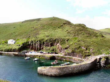
The Smugglers' Way
This was my winter 2009 project, which I had hoped to walk with friend and neighbour Richard. Unfortunately Richard got an injury and I ended up doing the walk solo. The Smugglers Way is the creation of Frank Squibb of Falmouth, who walked it in 1994 and published three editions of his guide booklet (see below), the latest version in 2002. If you are competive (I'm not) you could go for Richard Harvey's record of 6 hours and 48 minutes one way (he must have been running) or Dave and Anne Carrivick's there-and-back time of 21 hours and 37 minutes. Frank's booklet describes the route in both directions with sketch maps. Route descriptions are clear and easy to follow, maps are detailed enough. Frank divides the route into 8 short stages, the longest 7.2 miles. From north to south - the way I walked it - the trail runs from Boscastle harbour to Davidstow Moor, over the summit of Brown Willy, on to Jamaica Inn, by Dozmary Pool and over Brown Gelly to Dobwalls, on to Herodsfoot, and along the West Looe River to the Banjo Pier at Looe. There is camping at New Park Farm on the edge of Davidstow Moor and at Lower Trenant near Draynes. I divided my walk into four sections averaging around nine miles each. I used Ordnance Survey Explorer maps 111, 109 and 107 to help supplement Frank's directions and maps.
Read the guide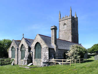
St Michael's Way
St. Michael's Way - 12 miles coast to coast
Read the guide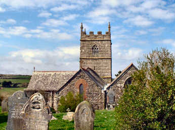
The Tinners' Way
This was my Spring 2011 project. It was inspired by Ian Cooke's excellent Tinners Way booklet, based on research by Craig Weatherhill and the late Hugh Miners, and by an article by Craig Weatherhill that I found in The Ley Hunter. The Zennor Churchway runs in lowland country from St. Ives to Pendeen. The Tinners Way, also known as the Old St. Ives Road, crosses the moors from Cape Cornwall to St. Ives. Using these, I walked first from St. Ives to Cape Cornwall and subsequently back, adding my own extension to the Churchway to get me to last short stretch to Cape Cornwall. The full distance is 31 miles, a challenge to those younger and fitter than me to complete in one or two days. This page has full details and route directions.
Read the guide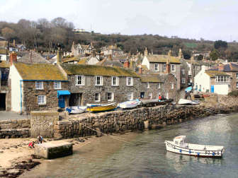
The Penwith Round
Devised by Alexandra Pratt and first published in The Celtic Way by Val Sanders Evans
Read the guide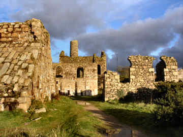
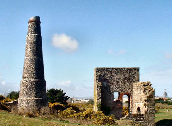
Mineral Tramways
Oliver's Cornwall - Mineral Tramways Trails
Read the guide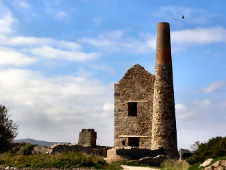
Inland Walks
This is a fairly new page, all inland, no coast, started only in November 2013
Read the guide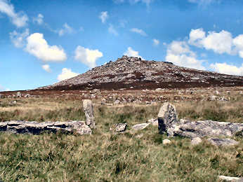
Bodmin Moor Walks
INTRODUCTORY FEATURES This page contains 28 round walks on and around the Moor, all researched between 2010 and 2012. Mostly from 5 to 10 miles in length, they contain Description, Diary, Interest, Statistics, Useful Info and a PDF file of Route Directions, with a few grid references to help locate significant features. Walks are grouped under area. In some cases, two walks can be joined to make one long one.
Read the guideThe Coast
chosen by Oliver Howes, retired driver/guide
Read the guide
Coastal Round Walks
Favourite Cornish Round Walks, based on the Coast Path
Read the guide
The Cornish Coast Path
This is the (almost) complete guide to the Cornish Coast Path. It carries Descriptions of each of 36 suggested stages, Oliver's Diary, Notes on Interest on and off the Coast Path, GPS Data and Useful Information on parking, transport, refreshments and more. Where possible I include features on places of interest along the way. Compiled in 2016, some may be out of date.
Read the guide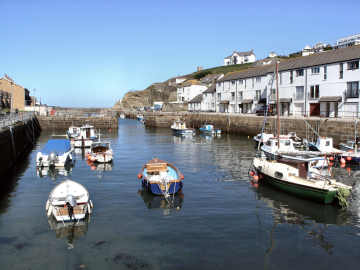
Coast to Coast Walk
Oliver's Coast-to-Coast Walkers Mining Trail
Read the guide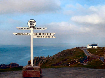
The Land's End Trail
Land's End Trail - 334 miles Land's End to Avebury
Read the guide