The Cornish Coast Path
This is the (almost) complete guide to the Cornish Coast Path. It carries Descriptions of each of 36 suggested stages, Oliver's Diary, Notes on Interest on and off the Coast Path, GPS Data and Useful Information on parking, transport, refreshments and more. Where possible I include features on places of interest along the way. Compiled in 2016, some may be out of date.
CORNWALL FROM THE COAST PATH: This is not just a guide to the Coast Path, but also to Cornwall from the Coast Path. Each stage includes information on Interest along the path and within easy reach of it. This includes towns, villages, harbours, homes, gardens, churches, antiquities and more. And you will find that, as with my other pages, there are many photographs - around 100 in all.
THE STAGES: The complete Cornish Coast Path runs for 312 miles according to my GPS. I have divided it into 36 stages - each between 4� and 13� miles - for the convenience of those for whom, like me, age precludes the distances we could once manage. Younger and fitter walkers will, I am sure, wish to link my stages to provide a challenge more in keeping with their abilities.
GPS DATA: For each stage I have included GPS data for distance, total ascent and biggest climbs. I have also included cumulative data. The actual distance covered may be more than the GPS figure and could vary by a few hundred yards for each stage. On occasion I may have strayed off the strict coast path to take in headlands or go down to coves, adding to the recorded distance.
Stage 01 - Welcombe Mouth to Bude - 10� miles
This first stage of the Cornish Coast Path needs to start just over the border in Devon. There is parking at Welcome Mouth, none at Marsland Mouth. This is one of the most strenuous stages. In the first 7 miles to Sandy Mouth there are 10 ascents, 8 of 240 feet or more. With another 500 feet after Sandy Mouth, and many undulations, total ascent to Bude is the equivalent of Helvellyn. There are a lot of steps, too, some 220 up and 500 down. After Stowe Cliffs, just before Sandy Mouth, the walking becomes easy all the way to Bude. It’s all well worth it for the great views, north to Hartland Point and Lundy Island, south to Pentire Point, and for the impressively jagged cliffs, some particularly colourful around Greenaway Beach, some of folded Crackington Shale – you will see more on the next stage - as at Gull Rock below Marsland Cliff. Along the way look out for Ronald Duncan’s Hut above Marsland Mouth, built by the poet and playwright for his work and restored by his daughter; for the ‘door’ in Gull Rock, below Marsland Cliff; for Hawker’s Hut on Vicarage Cliff at Morwenstow, built of driftwood by Parson Hawker, best known for writing The Song of the Western Men (the Cornish anthem “and shall Trelawney die”); for the vast GCHQ spy station on Steeple Point; and for superb sandy beaches approaching Bude.
A Coastal Round Walk from Bude and a Canal Round Walk
Oliver's Diary - GPS Data, Useful Info, interest
Stage 01 - Welcombe Mouth to Bude - Oliver's Diary
I walked this in October 2009 with my friend and neighbour Bob. It was a gloriously sunny early autumn day, ideal for photography. I was first here between 2003 and 2006 when a series of round walks covered this stage. This is one of those walks that works out just perfectly: the harsh coast and the tough walking are at the beginning, the gentler terrain and the easy walking towards the end. I was pleased to find that, since I first walked this section, the path up to Warren Point from Duckpool is no longer precarious; I remember there being no path up, as there is now, instead a scramble up a steep grassy slope; perhaps we actually missed the path at the time. I was pleased, too, that the National Trust’s Sandy Mouth car park now has a caf�; as I enjoy my breaks. I have unhappy memories of Northcott Mouth. Jane and I did a round walk from there in 2003; we arrived in thick fog and returned to discover that I had left the lights on and the battery was flat. Despite that, I have done that round walk – to Stowe Barton, Coombe and Duckpool – many times. And it now features on my Round Walks page. Bude continues to improve. Our first impression of it was that, apart from the superb beaches, it was quite a dire place. It is much improved and is now one of our favourite coastal towns.
Description - GPS Data, Useful Info, interest
Stage 01 - Welcombe Mouth to Bude - GPS Data
Distance: GPS 10.2 miles. Cumulative: GPS 10.2 miles. Intermediate: Sandy Mouth 7.00 miles. Ascent: Estimated 3000 feet. Highest Point: Henna Cliff 450 feet. Biggest climb: 310 feet up to Steeple Point. 5 other climbs of over 240 feet. Steps: Up 220, longest flight 110 steps to Vicarage Cliff. Down 500, longest flight 170 steps to Marsland Mouth. Stiles: Very few. Difficulty: Strenuous to Steeple Point, moderate to Menachurch Point, easy to Bude.
Maps: OS Explorer 126 Clovelly and Hartland. OS Explorer 111 Bude, Boscastle and Tintagel
Parking: Small free CP at Welcombe Mouth. Intermediate: CP at Duckpool, NT pay CP at Sandy Mouth, and CP at Northcott Mouth. Transport: Stagecoach bus 219 links Bude and Welcome Cross on A39. 216 links Bude and Morwenstow. Refreshments: NT caf� at Sandy Mouth car park. Seasonal shack at Northcott Mouth. Pubs, caf�s, restaurants in Bude. Toilets: Duckpool (seasonal), Sandy Mouth and Bude. Accommodation: Welcombe village, Morwenstow, Bude.
Stage 01 - Interest along the Coast Path Feature - Bude
Marsland Mouth: Welcombe and Marsland Valleys Nature Reserve. Hawker's Hut: Built from driftwood by the famed Parson Hawker of Morwenstow. The coast path passes right by. Tidna Shute: 'Waterfall' on OS map, impressive when the little river is in spate. Steeple Point: Radomes and dishes of GCHQ listening post. Bude: TIC with Bude Canal exhibition. Bude Castle, museum, exhibitions, excellent restaurant. Bude Canal: The sea lock was restored after storm damage. It leads to a tranquil harbourside, from which there is a pleasant level 2 mile towpath walk to Helebridge and the excellent Weir caf�/bistro. A Bude round walk includes the canal and a stretch of coast.
Stage 01 - Interest off the Coast Path Features - Morwenstow and Coombe
Morwenstow: 1.5 mile out-and-back detour from Vicarage Cliff to the two hamlets: Churchtown, Parson Hawker's church and vicarage; Crosstown, excellent The Bush Inn. Coombe: Delightful hamlet, ford and thatched cottages restored by Landmark Trust. Stowe Barton: (NT) The great house of the Grenville's was demolished in 1739; what remains is an attractive farmhouse and impressive farm buildings.
Rather inaccessible but well worth going out of one's way for, Morwenstow is Cornwall's most northerly parish, the 'holy place of St. Morwenna'. There are two tiny hamlets. Crosstown is a collection of farms around a large village green, one incorporating a small pub, the Bush. When I first knew it, two tiny bars had half-a-dozen tables and lunch was soup and a roll. Now there is a restaurant extension, all-day food, and accommodation. Nearer the coast is Churchtown. Here are just church, former rectory, Rectory Farm (teas in summer), and a holy well. In the churchyard are a Cornish cross, the figurehead of the 'Caledonia', wrecked off Higher Sharpnose Point, masses of daffodils in spring and St. John's Well, accessed separately. A Norman doorway leads into a church with Norman arcading, a medieval fresco and handsome Tudor bench ends, a carved Last Supper and a replica of the Caledonia figurehead. Most famous incumbent was Robert Stephen Hawker, rector for 40 years from 1834. Colourful, independent and charitable, his relaxations were the cliff-top and poetry. The two were combined in a driftwood shack he built into a cliff. Known to all as Parson Hawker, his best known poem is 'Song of the Western Men', its oft-quoted line "And shall Trelawney die?" a Cornish anthem. Other works include an Arthurian saga 'Quest of the Sangraal'. He is credited with introducing Harvest Festival.
A detour of just � mile each way on a quiet lane from Duckpool is extremely rewarding. Once part of the Stowe estate, the tiny village (more of a hamlet) of Coombe is now owned by the Landmark Trust, which specialises in restoring interesting historic buildings and letting them as up-market holiday rentals. The surrounding land is part of the National Trust’s Stowe Barton estate. The hamlet itself consists of a tall watermill, once known as Stowe Mill, the mill house, two semi-detatched cottages and a converted barn. All, apart from the mill, are rentable. The mill is intact, including all its machinery and a large waterwheel, but a large colony of bats prevents its conversion at present; how typical of wildlife conservation, which assumes bats can't find another roost. However, the Landmark Trust hopes to use the mill to provide Coombe’s electricity. The hamlet is divided by a small river with a shallow paved ford and a footbridge. Cottages are thatched and whitewashed, all are quite charming and easy to photograph. One pair of cottages is known as Hawker’s Cottages; for a while Rev. Stephen Hawker, rector of Morwenstow, lived in the left-hand one Don’t try to park here, there is no space. The car park at Duckpool is free and there are toilets there.
Like Portreath and Hayle, encountered later, Bude is a run-down but interesting town. When the railway arrived in 1898 it developed as a resort, with hotels and villas with sea views. After World War II it went downhill and now caters to the lower end of the tourist trade. However, it has many saving graces, not the least its superb Summerleaze Beach. A sea lock there is the start of the Bude Canal, of which 2 miles has been restored, that once carried sand inland to improve the soil. A Visitor Centre in the main car park acts as a Canal Heritage Centre. The canalside has been much attractively improved in recent years. Behind the beach, and not far from the canal, look out for the Castle, once the home of Sir Goldsworthy Gurney who built a steam road vehicle in 1829 and devised a complex system of arc lights and mirrors which lighted Parliament for 60 years before electricity. The Castle now has exhibitions about the town as port, resort and surfing centre. There is a Gurney exhibition; research centre; art gallery; shop and excellent restaurant. In front of the Castle, a sculpture, the Bude Light, commemorates Gurney’s achievements. Above the beach, to the south side, the octagonal Pepper Pot stands high on Efford Down, its sides marked with the points of the compass. Moved after cliff falls, it is now some 7 degrees out of true; views from it, over Bude’s beaches, are superb.
*******************************************************************************************
Stage 02 - Bude to Crackington Haven - 9� miles
Unlike Stage 01, this stage starts easy and finishes tough. From the sea-lock in Bude a path gently climbs Efford Down to the Pepper Pot and Beacon at 215 feet. The route on to Widemouth Bay is grassy and undulating with views north to Hartland Point, south to Cambeak and Tintagel Island. At Upton Cross it comes close to the road but stays off it. The high point of the first part of the stage is before Widemouth Bay at 220 feet. At Widemouth, unless the tide is right in, you will do best to walk on the beach to Black Rock. Soon after Black Rock, at Wanson Mouth, the more difficult section begins. Here you join the road for a steep ascent to Penhalt Cliff at 335 feet. Happily you soon leave the road to follow the cliffs down to Millook. The going really gets tough from here with a total of seven ascents to a maximum of 552 feet at the trig point above Dizzard Point. There are a lot of steps along the way, many of them quite high and steep, the biggest flights 133 steps up to above Mot’s Hole and 190 down to above Cleave Strand. There is a little road, up to Penhalt cliff and up again after Millook. Views disappoint a little. Although you can look back to Hartland Point and Lundy Island, looking forward you see no further than Tintagel Island. From Cancleave to Crackington Haven you are always on National Trust land.
A Coastal Round Walk from Bude and a Canal Round Walk
Folded strata of Crackington Shale at Millook
Oliver's Diary - GPS Data, Useful Info, Interest
Stage 02 - Bude to Crackington Haven - Oliver's Diary
I first walked this with my sister Mary in March 2005. I found it tough then. This time, walked from Bude to Crackington Haven in October 2009, it was tougher. This way the easy bits come first, the hard bits after Millook. Despite the challenge, I find this stage a little disappointing. Compared with most others, views are quite restricted, unless you keep looking back. Walking with Bob, we halted on Penhalt Cliff (round walk from here) where the view, north across Bude Bay to Steeple Point, Hartland Point and Lundy Island, is well worth lingering over. Looking south, the best view is from Chipman Point (welcome seat) where you see ahead a series of uneven headlands, ominous in dull weather. What I found toughest were the several steep descents with flights of high steps; not too bad going up but knee jarring on the way down, particularly the 190 steps down towards Cleave Strand. The strange woodland around Dizzard Point is of Sessile oaks, so stunted by Atlantic gales that few are more than 6 feet tall. After Millook there are few places where you can get down to the shore – really only at Cancleave Strand – a pity because there are impressive shutes (cliff waterfalls) along here. Looking at the map, you would expect the next stage to be tougher but the climbs, to High Cliff at 731 feet and Rusey Cliff at 680 feet, turn out to be much gentler than you might expect.
Description - GPS Data, Useful Info, Interest
The Coombe Barton Inn at Crackington Haven
Stage 02 - Bude to Crackington Haven - GPSData
Distance: GPS 9.74 miles. Cumulative: GPS 19.76 miles. Intermediate: Widemouth Bay 3.00 miles, Millook 5.05 miles, Dizzard Trig Point 6.65 miles. Ascent: Estimated 2800 feet. Cumulative: Estimated 5800 feet. Highest Point: Trig Point above Dizzard Point 550 feet. Biggest climb: 363 feet up to Pencannow Point before Crackington Haven. Steps: Up 255, longest flight 133 steps up to Chipman Point. Down 383, longest 200 down to Cleave Strand. Stiles: 16. Map: OS Explorer 111 Bude, Boscastle and Tintagel. Difficulty: Easy to Wanson Mouth then strenuous with some moderate to Crackington Haven. Some road.
Parking: Ample public pay CP in both Bude and Crackington Haven. Intermediate parking: Widemouth Bay, Black Rock and small CP on Penhalt Cliff before Millook. Transport: First Kernow bus 95 links Bude and Crackington Haven. Refreshments: Bay View Inn Widemouth Bay, seasonal caf�s Widemouth Bay, pub and caf�s at Crackington Haven. Toilets: In Bude, Widemouth Bay, Black Rock and Crackington Haven. Accommodation: Bude, Widemouth Bay, Dizzard, Crackington Haven
Pepper Pot: On Efford Down, above Bude, this distinctive monument was erected as a daymark. Its 8 sides are marked with points of the compass. When the cliff eroded it was moved to its present position but is now 7 degrees out of true. Widemouth Bay: A long sandy beach with good surfing. Otherwise it is a pretty dire place. Crackington Shale: The cliffs along this stage, and along much of the next, are of Crackington Shale and much subject to landslip. The strata are often folded, a strange effect best seen at Millook and at Cambeak on Stage 03. Millook: A tiny haven from which sea bass is fished. One of the few cottages was once a mill and still has its wheel. The Dizzard: Strange vegetation, a ‘bonsai’ forest of dwarf sessile oaks, stunted by Atlantic gales. Also rare service trees. Crackington Haven: Small haven, once a busy port, surrounded by high cliffs. Now popular with day visitors, the beach is sandy in the inter-tidal part. The Coombe Barton Inn has accommodation and there are two caf�s and a beach shop.
St. Gennys: You can detour from the Coast Path, a little before Castle Point, to see one of Cornwall’s tiniest villages. The church, tucked into a hollow, is named for St. Genesius. It is partly Norman, partly 15th century. A Holy Well is almost hidden below the graveyard; its water has been used for baptism since the 7th century.
*******************************************************************************************
Stage 03 - Crackington Haven to Boscastle - 7� miles
At Crackington Haven the sign says ‘Boscastle 6� miles’. It is actually about 7� miles but feels like more thanks to the ascents and descents and the large number of steps, some of them with high risers. Longest ascent flight is 187, after Pentargon Shute, longest descent 165, coming down from High Cliff. Some inclines are rocky and could be slippery in wet weather, many are stony and need care. Highest point is High Cliff at 731 feet but Rusey Cliff at 681 feet is more challenging. In good weather this is a very scenic stretch. In bad weather it can seem isolated and threatening even though rarely more than half-a-mile from habitation. The stage starts with a stiff climb up to Cambeak at 330 feet, with great views back to Crackington Haven. It is then relatively moderate until the ascent of High Cliff. After a steep descent from High Cliff - all those steps - it is again fairly moderate across Strangles with its tortured rock strata and landslips. The climb up to Rusey Cliff is the stiffest of the stage. By now views have opened out to the south to Tintagel and Trevose Head. You might expect it to be easy from here but still to come is Pentargon – look out for the 175 foot waterfall – with 167 steps up in a 150 foot climb. From here on it is easy going. Distance is calculated to the road at Boscastle but those continuing to Tintagel can cross the new steel and concrete bridge.
Oliver's Diary - GPS Data, Useful Info, Interest
Stage 03 - Crackington Haven to Boscastle - Oliver's Diary
When I walked this in 2004 I did it the easy way as two round walks to High Cliff, returning by an inland route each time. I found it all fairly easy at the time. Five years on, walking from Crackington Haven to Boscastle with Bob in November 2009, my 72 year old joints found it tougher than expected. Part of the reason was the weather. A day of sunshine and showers, the showers were heavy and sometimes of hail. The wind on the cliffs was gusting to 50 mph, fortunately onshore, and several times we had to stop and lean on our poles to stay upright. It made for an exhilarating, if rather tiring, walk. What I found toughest was the two long flights of steps, particularly the long flight down from High Cliff. To old joints the high risers can be quite jarring. At Pentargon, even though relatively sheltered down by the footbridge, the wind was still so strong that spray from the waterfall was being carried in a sheet high in the air. I found the best views along the way to be those back into Crackington Haven from Cambeak and those from Fire Beacon Point onwards, looking south-west across a series of high headlands. And, as in 2004, I was much taken by the remarkable folded strata of Crackington Shale (see Stage 02) at Cambeak and along Strangles. After Cambeak do look out for Northern Door and Samphire Rock.
Description - GPS Data, Useful Infor, Interest
Stage 03 - Crackington Haven to Boscastle - GPS Data
Distance: GPS 7.43 miles. Cumulative: GPS 27.19 miles. Intermediate: High Cliff 3.16 miles, Fire Beacon Point 5.18 miles, Hillsborough 6.14 miles. Ascent: Estimated 2500 feet. Cumulative: Estimated 8300 feet. Highest Point: High Cliff 731 feet. Biggest climb: 335 feet up to High Cliff. Plus 3 others over 200 feet, including 300 feet up to Rusey Cliff. Steps: Up 245 includes flight of 187 up to Hillsborough. Down 440 includes flight of 165 down from High Cliff. Stiles: 15, includes a few tall slate stiles. Maps: OS Explorer 111 Bude, Boscastle and Tintagel. Difficulty: Overall strenuous with some moderate, some gentle
Parking: Ample public pay CP in both Crackington Haven and Boscastle. Intermediate Parking: May be intermediate parking at National Trust’s Trevigue.
Transport: First Kernow bus 95 links Crackington Haven and Boscastle. Refreshments: In Crackington Haven (see Stage 02) and many pubs, caf�s and restaurants in Boscastle.
Toilets: In Crackington Haven and Boscastle. Accommodation: Crackington Haven, Trevigue, Boscastle
Cambeak: A positively reptilian-looking headland with remarkable folded formations of Crackington Shale rock. Northern Door: Storm-worn cleft in a rock jutting out near Cambeak, not one of the largest or most impressive. High Cliff: At 731 feet, you expect the cliffs here to be more impressive but landslip means that the sloping undercliff changes your perspective to reduce the feeling of height you get with other vertical cliffs like Penkenna above Crackington. Pentargon Shute: An impressive waterfall, if you have the courage to get in position to view it properly. Boscastle: An attractive harbour village, well worth exploring. Because of the winding entrance, the little harbour is only in water for part of each tide. There are still a few working boats. The village itself, on the little River Valency, has been well restored since the dreadful 2004 flood. There is a visitor centre and National Trust shop and caf� in the former pilchard palace and there are plenty of caf�s, pubs and restaurants. Also a vast car park. Full Boscastle feature below.
Trevigue: National Trust owned farm, attractive 16th century house and farm buildings tucked into a hollow. Diversified activities include B&B, self-catering, evening restaurant, a wildlife information centre, even civil marriages. You may see their South Devon cattle grazing and their Dartmoor ponies and feral goats grazing the cliffs. Worth the � mile detour. St. Juliot: Follow the north bank of the River Valency through woodland to Newmills and continue across fields to St. Juliot’s church. Thomas Hardy associations, Lawrence Whistler engraved glass window, Hardy drawings, Cornish crosses in the churchyard. 5 miles return walk, worth adding to the next short Stage 04 to Tintagel. Smugglers Way: A 37 mile walking trail from Boscastle Harbour to Looe on the south coast. The trail was devised by veteran walker Frank Squibb and has the great advantage of climbing the heights of Bodmin Moor - including Roughtor, Brown Willy and little visited Brown Gelly – and passing Dozmary Pool, the mythical Arthurian site.
When I started this web site I didn't like Boscastle very much. I was about ready to post a critical item when the dreadful flood of August 2004 happened. That was no time for criticism so I decided to leave it until repair and restoration were complete. I am glad I did because, before and after a walk up the Valency Valley in June 2008, I took time to explore the village. Now not only am I most impressed by the way Boscastle has recovered but I also find that I now like it. It may be very tourist oriented - Visitor Centre, National Trust shop, Witchcraft Museum, art and craft galleries, gift shops, restaurants, caf�s - but it looks terrific. Scenically it is hard to beat thanks to its setting in a steep valley, the River Valency winding down to a small harbour (dry at low tide) with a few fishing boats, beyond it two high headlands, both on the coast path, and the sea. In the photo a lime kiln stands in front of the former 'pilchard palace'; this latter houses the TIC, a National Trust shop and caf� and a Witchcraft Museum. And don't miss walking up Old Road, a narrow no-entry street, to admire its charming cottages. I can't comment on eating places as I have only had coffee here, but for sociability the Wellington Hotel bar is probably top; other pubs are the Cobweb opposite the car park and the Napoleon at the top of the village.
Description - Oliver's Diary - GPS Data, Info, Interest
***************************************************************************************
Stage 04 -Boscastle to Tintagel - 4� miles
This is a very short stage and those who are looking for distance will prefer to add Stage 5 and continue to Port Isaac. Those looking for interest may well find this mere 5 miles quite adequate. The villages at each end are both worth exploring – despite some views of them as tourist traps – and there is intermediate interest off the path which could add several miles to the day’s walk. Degree of difficulty is only moderate, ascending only around 1200 feet and none of the ascents are particularly steep with a mere 160 steps up and down. For interest, use the north side of the River Valency at the start and cross the new footbridge to start the ascent to Boscastle’s Willapark, looking back down to the tiny harbour. If you detour up Willapark to the Coastwatch station, there are fine views. After Willapark, note the long thin fields, Forrabury stitches, and Forrabury church to your left. Above Grower Gut there is a beautifully made sheep stile and views open out to the north to Cambeak and Hartland Point. After Trevalga Manor, Ladies Window seems lost to rockfall. Soon after, views open out to Tintagel. Steepest ascent of the day is up from Rocky Valley, thereafter going is pretty easy and views over Benoath Cove and Bossinney Haven are grand. As you approach Tintagel Haven you get a view of the castle on The Island.
The Coastwatch lookout on Boscastle's Willapark
Oliver's Diary - GPS Data, Useful Info, Interest
Stage 04 - Boscastle to Tintagel - Oliver's Diary
After fairly tough going on the first three stages, I was glad of a short, fairly easy stage, done in October 2009. Despite their reputations as tourist traps, I was happy to linger a while in Boscastle and Tintagel, both of which I enjoy. Scenically, I find this a less interesting stretch. Looking forward, views never extend beyond Tintagel so you need to look back from time to time. It was a fine warm and sunny day so, when I got to Tintagel, after a snack at the Castle Caf�, now very greatly improved as are castle visitor facilities, I headed on to Trebarwith Strand and back across the fields into Tintagel village, lingering on the way for another look at the Fontevreux Chapel and the Dovecote in the Old Vicarage garden. Along the way, the path crosses a very strange little smallholding. From all the signs, you get the distinct impression that the owners live in fear of walkers (or perhaps local hooligans); it seems a shame that the path has to go this way. I also enjoyed the coastal slate quarries, described in the next stage. And one of my favourite places is St. Materiana’s church, standing on a site that was almost certainly occupied from the late iron age. Glebe Cliff nearby has superb views of Tintagel Castle. As with Boscastle, described in Stage 03, my views on Tintagel have changed with time, as has the village itself. Brief description below.
Description - GPS Data, Useful Information and Interest
Stage 04 - Boscastle to Tintagel - GPS Data
Distance: Boscastle Bridge to Tintagel Castle 4.6 miles. Cumulative: 31.97 miles. Intermediate: Rocky Valley 2.8 miles. Ascent: Estimated 1200 feet. Cumulative: Estimated 9500 feet. Highest Point: Above Short Island 295 feet. Biggest climb: 290 feet up out of Boscastle. Only one other over 200 feet, 205 feet up from Rocky Valley.
Steps: Up 160, including flight of 75 up from Bossiney Haven Down 160, including 60 down to Grower Gut. Stiles: None. Maps: OS Explorer 111 Bude, Boscastle and Tintagel. Difficulty: Overall moderate but with a little strenuous and a lot of easy.
Parking: Good public CP in Boscastle. Ample public CPs in Tintagel. Intermediate Parking: No intermediate parking. Transport: First Kernow bus 95 links Boscastle and Tintagel 2 hourly. Refreshments: Ample restaurants, caf�s, pubs in both Boscastle and Tintagel. Toilets: Only at Boscastle and Tintagel. Accommodation: Boscastle, Trevalga, Bossiney, Tintagel.
Boscastle: An attractive harbour village, well worth exploring. Because of the winding entrance, the little harbour is only in water for part of each tide. There are still a few working boats. The village itself, on the little River Valency, has been well restored since the dreadful 2004 flood. There is a visitor centre and National Trust shop and caf� in the former pilchard palace and there are plenty of caf�s, pubs and restaurants. See Stage 03 for a Thomas Hardy walk up the Valency Valley and Coastal Round Walks for a related circuit. Forrabury Stitches: Landward of Willapark, and owned by the National Trust, as is much of the land around Boscastle, the Stitches are a rare survival of Celtic farming. There are 42 stitches (plots), narrow and separated by low balks. They were used as arable in summer, grazing in winter. Bossiney Haven: A sandy cove is covered at high tide; access is by steep steps. A rock with a 'door' in it is known as Elephant Rock. Adjacent are the golden sands of Benoath Cove. Tintagel: Very much a tourist village, Tintagel used to be a very down-market, scruffy place but, following a �2.4 million makeover, is now much improved. Inevitably the emphasis is on King Arthur but there is more to Tintagel than just that. Full Tintagel feature below. Full Boscastle feature in Stage 3
Rocky Valley: Spectacular narrow valley, carved by the little River Trevillet, which tumbles down the narrow defile into the sea at an equally spectacular cove. At one point maze-like shapes have been carved into the rock. The valley continues inland as St. Nectan’s Glen but you have to walk a section of road to approach that from Trethevy. Trethevy: For a village totally ignorable from the road, a surprising amount of interest - St. Piran’s Well, a Roman milestone in a private garden and a massive flat rock by the road, known as King Arthur’s Quoit; is he buried under it? Trevalga: A charming hamlet, its last Lord of the Manor, Gerald Curgenven, left it in 1959 to a trust managed by Marlborough College, his old school. To see the village, leave the coast path on a track just before Trevelga Manor. In 2010 the hamlet's fate is in doubt as the college has put the complete package on the market.
Most come to seek King Arthur and Tintagel Castle. For that, park in the designated car park, walk to the Island, climb it, enjoy the views and drink your fill of history, real or mythical. Dedicated Arthurians will also look almost opposite the National Trust's Old Post Office for King Arthur's Halls, an odd mix of Pre-Raphaelite mythology and modern audio-visual. The Old Post Office is really a small 14th century manor house, used in Victorian times as the local mail receiving office. Away from the village, high on cliffs to the west, St. Materiana's church is worth seeing in its own right; close by are ravishing coastal views and an impressive view of Tintagel Castle from Glebe Cliff. On the way to the church, look out for the Vicarage; enter its ancient gatehouse to find a simple chapel, once a 13th century cottage; look over its garden wall for a medieval dovecote. Inside the church, a simple Norman granite font stands on a most unusual plinth of small upright slates set in a checker pattern, almost as if Sir Edwin Lutyens had designed it as part of one of his garden paths. Wood work in the church is unusual; the reredos appears to be made of old bench ends which carry carvings of the Passion and of local coats of arms. The village has improved greatly (it cost �2.4 million) but shops, caf�s and restaurants are still mostly aimed at the tourist trade and almost all rely on the Arthurian connection.
The Old Post Office, really a 14th century manor
Description - Oliver's Diary - GPS Data, Useful Info, Interest
****************************************************************************************
Stage 05 - Tintagel to Port Isaac - 9 miles
This is the toughest stage so far with 11 ascents, mostly steep, of 100 feet or more, the greatest of 330 feet. It is genuinely strenuous with one potentially dangerous section. There are several flights of steps, most of them up. You reach Trebarwith Strand down 120 steps and leave it by a flight of 203. There are more stiles than before, probably the National Trust influence since most are of the English wooden variety. Surprisingly there are four part-granite sheep stiles, again probably National Trust since their character is not local. View are not extensive but the view forward over Port Isaac Bay to the Rumps is always splendid. After a fairly stiff climb up from Tintagel Haven the first two miles to Trebarwith Strand is easy. It is at Trebarwith that the serious stuff starts with a 330 foot climb up to Start Point. From there towards Port Gaverne there are half-a-dozen serious descents and ascents. The potentially dangerous spot is between grid references 025/815 and 023/812. Here the steep descent is covered in loose stone and the steep ascent is potentially very muddy. In poor weather this section may require great care. From about a mile before Port Gaverne the stage becomes easy and the last 2 miles may, despite the steep road up to Port Isaac car park, come as something of a relief. Overall challenging stage but most rewarding.
Oliver's Diary - GPS Data, Useful Info, Interest
Stage 05 - Tintagel to Port Isaac - Oliver's Diary
I walked this stage with Bob and his wife Pam in November 2009. I had first done it from Trebarwith Strand to Port Isaac in January 2005 and found it fairly tough going then. Five years on I found it the toughest stage so far and one I was pleased to complete without mishap. What appeals to me most about this stage is the almost continuous glorious view across Port Isaac Bay. It may not be a long view but it ends at one of my favourite spots, the Rumps with its great promontory fort or cliff castle. And, much of the time, you can see your destination Port Isaac – though sometimes it seems not to get any closer. I also enjoy the evidence of slate quarrying, most of the way from Tintagel to Delabole Point. In 2005 I saw a pair of choughs at Jackett's Cove, sadly not this time. I was very wary of the potentially dangerous section (location above) and slipped on the way down a couple of times. I was delighted to learn about some new interest, thanks to Pam’s local knowledge: Dannon Chapel, just off the path and, at Delabole Point, a feature shown on OS109 as ‘cave’ but probably a tunnel hewn by slate quarrymen through a small headland to a cove – there is another further on. If your timing is right, and the Port Gaverne Hotel is open when you get there, I recommend the local crab sandwiches – Port Isaac is famed for its crabs. Having cracked this one I am looking forward to Port Isaac to Rock, the crossing point for Padstow.
Description - GPS Data, Useful Info, Interest
Stage 05 - Tintagel to Port Isaac - GPSData
Distance: Tintagel Castle to Port Isaac Harbour 9.04 miles. Cumulative: 40.83 miles. Intermediate: Trebarwith Strand 2 miles, Jackett’s Cove 5.24 miles, Bounds Cliff 6.77 miles. Ascent: Estimated 2500 feet. Cumulative: Estimated 12000 feet. Highest Point: Sheep stile at grid ref: 023/812 at 419 feet. Biggest climb: 310 feet up from Tintagel Haven. Also 295 feet up to Bounds Cliff. Steps: Up 472, includes flight of 203 out of Trebarwith Strand. Down 170, includes flight of 120 down to Trebarwith Strand. Stiles: 18, includes 4 unexpected granite sheep stiles. Maps: OS Explorer 111 Bude Boscastle & Tintagel, 109 Bodmin Moor and 106 Newquay and Padstow. Difficulty: Moderate start for 2 miles then strenuous for next 5, with one potentially dangerous section in bad weather.
Parking: Ample public pay CP in both Tintagel and Port Isaac. Intermediate parking: Pay CP at Trebarwith Strand and a very little at Port Gaverne. Transport: First Kernow bus 95 links Tintagel and Port Isaac. Refreshments: In Tintagel (inc. Castle), Port William pub and caf�s Trebarwith Strand, Port Gaverne Hotel, Port Isaac. Toilets: In Tintagel (including Castle), Trebarwith Strand and Port Isaac by harbour. Accommodation: Tintagel, Trebarwith Strand, Tregardock, Port Gaverne, Port Isaac
Tintagel: See Stage 04. Slate Quarries: This part of the coast has been much changed by coastal slate quarrying. The cliffs have been worked almost all the way from Tintagel to Trebarwith Strand, the quarrymen hanging by ropes down the cliff-face, their slates raised to the top, later to be lowered at high tide by winch to awaiting vessels. There is more further south, notably at Backways Cove, above which blocked shafts suggest former cliff-top mines, and at Delabole Point. Trebarwith Strand: An odd little place. The Strand is popular with surfers but not easy to access. You may wonder how slate was exported from here. If you walk up past the Port William Inn – OK to eat but horrendously expensive coffee (2009) – you will find the rocky inlet where the slate boats loaded. Delabole Point: Marked on OS 109 as ‘adit’, this is another slate quarry tunnel. Sheep stiles: Between Barratt’s Zawn and Tresungers Point there are four sheep stiles which I don’t remember seeing before. Set in slate hedges are the granite steps of a typical sheep stile – but they are too closely spaced to deter sheep; must be the work of the National Trust. Vaccary Wall: I have seen these fences of thin upright stones wired together in Lancashire and at Kelmscott on the Thames. You don’t really expect them in Cornwall but there is a superb cliff-top one about a mile before Port Gaverne. Port Isaac: Now known to all through the Doc Martin TV series, Port Isaac has become much gentrified and second-homed over the years. Retains a working harbour and superb crabs and lobsters are sold in the former fish cellars. See full Port Isaac feature.
Dannon Chapel: Waymarked from near Crookmoyle Rock, an abandoned hamlet going to rack and ruin.
Jane remembers Port Isaac, from her early childhood, as a quiet remote small harbour village with little activity other than the busy fish harbour. It is very different these days, having been discovered not only by the holiday trade but also by the second homers from the big city. It may now be far busier than she remembers but it is also, thanks to the influx of money, more colourfully attractive. The old part of Port Isaac is crammed into a tight steep valley leading down to a tiny fishing harbour where crab and lobster are landed. Do not try to drive down to the harbour; you will be unable to park there. You should park in the official car park at the top of the hill and walk down, enjoying the delightful views; the narrow streets can be very difficult to negotiate in a car, even away from school vacation times. Small cottages, closely packed together, have white washed or tile hung walls. There are still fish cellars on the west side of the harbour where you can buy fresh fish and shellfish but the crab and lobster, the main catch, mostly leave the harbour and head uphill for immediate distribution. Even so, we can strongly recommend the crab. Since 2004 Port Isaac has become best known as the location for 'Doc Martin', a TV series shot in and around the village; an odd show, first comedy, later melodrama and packed with great location shots.
Description - GPS Data, Useful Info, Interest
Port Isaac harbour and village from the coast path
*****************************************************************************************
Stage 06 - Port Isaac to Rock for Padstow - 11� miles
This is one of the most scenic stages of the Coast Path. Views are never particularly long but they are superb. To the north the view is restricted to Tintagel though, on a clear day, you might just see north Devon and Lundy Island. Forward you look across Port Isaac Bay to the Rumps and Mouls though, once you reach them, you see Pentire Point and from there you have lovely views across the Camel Estuary to Stepper Point and Trevose Head. The going starts quite strenuous but eases after Port Quin and from Pentire Point it is easy going all the way. Approaching Polzeath, you may well find that you can use the beach - the tide goes out a long way - to cut out most (or all) of the village. Alternatives are suggested below for the final section from Daymer Bay to Rock. The total ascent of 2350 feet, with 9 climbs of 100 feet or more, is less than on Stages 01 and 02 but the 511 steps up and 379 down are quite steep in places with some high risers. Under foot is a mixture of grass and stony path with only occasional rocky parts. New Polzeath to the ferry at Rock is very easy going. Rock is an expensive place so best to arrive in good time to take the ferry to Padstow for a better choice of eating places and accommodation. It is worth making an early start on this stage for the considerable amount of interest along the way both on and off the path.
Alternatives - Oliver's Diary - GPS Data, Useful Info, Interest
PORT ISAAC to PORT QUIN: This is a fairly tough stage. Those who might like to omit the toughest part can take an alternative inland route between Port Isaac and Port Quin. As you climb up out of Port Isaac, look out for a stile and footpath sign on your left. The path goes fairly directly to Port Quin. There is one steep valley, the Pine Haven valley, but the path goes obliquely, both down and up, so it is easy. If you want to take a look at Roscarrock (see Interest off the Coast Path below) it is easily accessed soon after this valley.
Stage 06 - Polzeath, Daymer Bay and Rock - The Alternatives
1. Polzeath: At low tide, if you wish and if you enjoy beach walking, you can get down to the beach at Pentireglaze Haven or at New Polzeath and cross the sands of Hayle Bay to an easy cliff ascent to the grassy car park at Tristram.
2. Daymer Bay to Rock: (a) Tides permitting, when you reach Daymer Bay, you can walk on the beach all the way to Rock and the ferry.
(b) At any time you can take an inland alternative. Leave Daymer Bay up Daymer Lane and take a track on the right leading to St. Enodoc golf course. A line of white stones leads you first to fascinating St. Enodoc church and then to the dunes on the coast path to Rock.
Stage 06 - Port Isaac to Rock for Padstow - Oliver's Diary
I walked this with Bob on a fine November 2009 day. Despite its familiarity I always get great pleasure from it, not least because of my history with it. Back in 2003 my (younger) sisters told me I shouldn’t try it as it would be too much for me. They were probably right at the time but, since then, I must have walked it a dozen times. On a long day I love to make detours for all the interest. On a short day I may take the easy inland alternative from Port Isaac to Port Quin. Poldark fans will find Port Isaac, Port Quin and Doyden Castle familiar, the former also from Doc Martin. The more adventurous Poldark devotees may also like to detour to Roscarrock, something I have only done using the alternative easy inland route from Port Isaac to Port Quin, worth using for the time - and energy - it saves if you are in a real hurry. In summer I liked to take a coffee break at Atlantic House (now expensive apartments) in New Polzeath for the view of Hayle Bay and its multitude of surfers. Sometimes, at low tide, I will cross the beach from there to the bottom of Tristram car park; the little river is easily fordable; you can also cross from the earlier Pentire Haven or Pentireglaze Haven at really low tide. Sometimes, too, I will take the variations above on my way from Daymer Bay to Rock. This is a wonderful walk and even better for a fine day.
Description - Alternatives - GPS Data, Useful Info, Interest
The Rumps from the Lawrence Binyon memorial
POLZEATH REFRESHMENTS: Looking for somewhere to get a coffee in winter in Polzeath, we happened upon Tubestation. Open Tuesday to Saturday throughout the year, it's in the former Methodist chapel. It's dog friendly, child friendly (complete with a small skateboard ramp), serves good soups and sandwiches and great coffee. The welcome is genuine, the place feels comfortable and the prices are very reasonable.
Stage 06 - Port Isaac to Rock for Padstow - GPS Data
Distance: Port Isaac Harbour to Rock Ferry 11.47 miles. Cumulative: 52.30 miles. Intermediate: Port Quin 3.16 miles, Pentire Point 6.94 miles, Polzeath 8.71 miles, Daymer Bay 10.03 miles. Ascent: Estimated 2350 feet.
Cumulative: Estimated 14350 feet. Highest Point: Between Rumps and Pentire Point at grid ref: 930/807 267 feet. Biggest climb: 222 feet up from Lundy Bay. 4 other climbs of over 150 feet. Steps: Up 511, includes 176 up from Pinehaven, 145 up to Reedy Cliff. Down 379, 3 flights of more than 50. Stiles: None but a number of gates and kissing gates. Maps: OS Explorer 106 Newquay and Padstow. Difficulty: Overall moderate but strenuous in places, especially to Port Quin. Easy from Pentire Point to Rock.
Car Parking: Ample public CP at Port Isaac and at Rock (busy high summer). Intermediate Parking: NT (free to members) Port Quin, NT (free) Lead Mines at Pentireglaze Farm, New Polzeath (some free), Polzeath, Daymer Bay. Transport: First Kernow bus 96 links Port Isaac with Polzeath and Rock. Refreshments: Ample in Port Isaac. Mostly seasonal in Polzeath. Pubs and seasonal in Rock. Toilets: Port Isaac, Polzeath, Daymer Bay, Rock. Accommodation: Port Isaac, Polzeath, Daymer Bay, Rock, Padstow.
Stage 06 - Interest along the Coast Path - See feature on the Camel Estuary, Polzeath and Rock
Port Quin: Picturesque and very photo-worthy tiny former fishing village, now mostly owned by National Trust. Doyden: Just after Port Quin, Doyden Castle, an unusual small folly, is now rented out by Landmark Trust. It featured in the first Poldark TV series as the home of Dwight Ennis. Mineshafts nearby have unusual slate fence posts. Lundy Bay: Look out for the blow-hole as you leave Lundy Bay and try to catch it on a stormy day with a high tide. The Rumps: Major iron age promontory fort or cliff castle, several ramparts are still clearly defined. Worth the detour. A little after the Rumps a memorial to poet Lawrence Binyon makes a superb viewpoint. Polzeath: Along with Rock and Trebetherick, Polzeath is at the heart of second home territory of Kensington-on-sea. There are several caf�s (mostly seasonal and too expensive - Tubestation is the honourable exception) and several surf schools – surfing is safe. Brea Hill: Several bronze age cairns stand on the summit. Worth the detour for these and views, including that down to tiny St. Enodoc church. Rock: Cornwall's most expensive homes include apartments costing millions. The sailing club members range from dingy to cruiser owners and there is a water ski school. Golfers are catered for by the exclusive St. Enodoc Golf Club. St. Enodoc Hotel boasts Nathan Outlaw's Michelin starred restaurant. Tiny St. Michael Porthilly church stands just above the beach at the eastern end of Rock. Ferry: A landing craft type of ferry carries pedestrians and cyclists between Rock and Padstow. At night a separate service carries foodies across to Padstow. Padstow: Once only a fishing village, with harbours for inshore boats and seagoing trawlers, Padstow has become a major visitor destination and is unbearably busy in the season but almost deserted in winter. See full feature on Padstow.
Roscarrock: If you take the shorter inland route from Port Isaac to Port Quin you can bear off SW to see the ancient house and farmyard that featured in the first Poldark, the house as Ross’s Nampara home, the farmyard in other rural scenes. St. Enodoc Church: The tiny ancient church, with its stone spire, was once almost completely covered by the shifting dunes. To maintain his living the vicar had to climb in through the roof once a year to hold a service for a congregation consisting of himself. Buried in the churchyard are poet laureate John Betjeman and Fleur Lombard, the first female fire-fighter to die doing her job in peacetime. Half-a-mile across the golf course from here is the Jesus Well.
If Newquay is Cornwall's down-market playground, the Camel Estuary is its up-market counterpart. This is where the rich gather; the permanent rich all year, the vacationing rich in season. In summer you might be in 'Kensington-on-Sea', an impression especially strong a few years ago when the royal princes would holiday here. Rock’s main activity is sailing and the estuary is often crowded with small boats. Windsurfers congregate at Daymer Bay - though not in summer as it's a family beach then - surfers at Polzeath. Social life centres around Rock sailing club, St. Enodoc Hotel and - for the drinkers - the Mariners and Rock Inn by the water. Golfers enjoy St. Enodoc Golf Club, one of Cornwall's best - and most expensive! During the day coast path walkers cross the water from Rock, by ferry to and from Padstow. In the evening foodies cross from Rock to Padstow for Rick Stein's famed Seafood Restaurant and other top spots. Polzeath’s raison d’�tre is surfing with hire shops and stalls, surf schools, and caf�s priced for well-heeled surfers. At least there is a reasonably priced seasonal snack wagon, Mr. Surfy’s on Atlantic Terrace in New Polzeath, and Tubestation in Polzeath is recommended. The surfing is among the safest, best and busiest in Cornwall and I have counted 200 in the water on occasions. Spring tides go out for the best part of half-a-mile. Car parking is on the beach but beware high spring tide, you might return to find your car awash.
Description - Oliver's Diary - GPS Data, Useful Info, Interest
To first-time visitors this will seem like unchanging Cornwall. But for those who remember Padstow from the 1940s, things have changed greatly. The railway has gone - it's now a cycle trail, the Camel Trail. Most restaurants and shops concentrate on tourists; foodies have arrived, enticed by Rick Stein's famed seafood empire. Fishing boats do still land their catches (much of it is exported ) and many restaurants specialise in seafood. Views across the Camel estuary are to the village of Rock and a little ferry carries hikers and holiday makers. Cream teas are all you expect; we prefer to take ours in the lounge of the Metropole. Some of the Cornish pasties are good, too, especially at the Chough bakery close by the harbour and at Rick Stein’s patisserie. Wander around narrow, steep streets; walk up the hill behind the town to visit the 'great house', Prideaux Place. For all this, Padstow is no longer very likeable. In the season it heaves with people and cars; out of season it seems deserted, caf�s and restaurants closed, many shops closed. Thanks to second homers, housing is very expensive so less and less native Padstonians actually live there. It should be a lovely small harbour town but now it disappoints us. The Camel Trail starts here, offering cyclists an 18 mile trail to Wenford Bridge, by way of Wadebridge and Bodmin, on level hard surfaces.
Description - Oliver's Diary - GPS Data, Useful Info, Interest
**************************************************************************************
Stage 07 - Padstow to Porthcothan - 13� miles
Looking across the Camel estuary from the heights of Pentire Point on the previous stage, you see two major headlands, Stepper Point and Trevose Head. You might, therefore, expect this to be a tough stage but the ascents of those headlands are only moderate while the rest of the route is easy. The path, starting on tarmac, is soon clear of Padstow and, at the War Memorial, delightful views begin - over the Camel estuary to Daymer Bay, Polzeath and Pentire Point. A stony track soon becomes a regular path undulating gently until you pass the Coastguard Cottages at Hawker’s Cove. The climb to the Pepper Pot on Stepper Point starts easy and becomes moderate. Once there, forward views are to Trevose Head and its lighthouse. Here the path becomes mostly grassy and walking is easy all the way to Trevose Head, again only a moderate ascent. After steep steps down to Dinas Quarry, and a short ascent, the path is again grassy all the way to Booby’s Bay. Long views open out south-west across Constantine Bay, taking in Kelsey Head, St. Agnes Head and St. Ives. The path crosses the half-mile beach at Constantine Bay, heavy going sometimes. Going is then easy to Porthcothan, nowhere climbing above 130 feet, and the path is grassy most of the way. At Porthcothan you are briefly on the road but soon back on the cliffs.
Oliver's Diary - GPS Data, Useful Info, Interest
2012: Good news for those who like to stop for a snack in lovely surroundings. A couple of miles out of Padstow, towards Stepper Point, Rest-a-While is in the garden of 7 Coastguard Cottages at Hawker's Cove. Open daily in summer, weekends in winter, it serves soup, sandwiches, cakes, cream teas and hot and cold drinks. Seating is on a terrace with glorious views over the Camel Estuary. We have tried it a couple of times - good food, good coffee, good value. And see Diary below for YHA Trey Bay
Stage 07 - Padstow to Porthcothan - Oliver's Diary
I probably know this bit of the Cornish Coast better than almost any other. It was my first real introduction to the Coast Path back in the 1990s. Then it was just doing Padstow to Trevone with an inland return route, a total of about 7� miles. It is a walk I often return to when I fancy an easy Saturday walk. I also like to take the bus to Harlyn Bay or Constantine Stores and walk back to Padstow, sometimes using the inland route from Trevone. Although I can think of many more striking parts of Cornwall’s north coast, especially between Marsland Mouth and Pentire Point, and round West Penwith, I never tire of this part, partly because of my love of the Camel Estuary and its lovely ever changing views. Another reason I (and Jane) particularly like these parts is Food for Thought, the excellent seasonal snack shack at Harlyn Bay, where you can enjoy superb hot filled baps while watching the surfers disporting themselves along the lovely gently curving bay. I also like to walk out to Dinas Head, not on the Coast Path, and to try to catch the surf crashing into Round Hole nearby. I find this stage very pleasant, relatively easy walking. The only disappointments are Porthcothan, a most uninspiring place, and the pubs along the way; both the Harlyn Inn and the Tredrea Inn at Porthcothan are rather 'urban roadhouse', not really my style.
Description - GPS Data, Useful Info, Interest
TREY BAY, NOV 2016: Strongly recommended as a place to eat is the YHA at Treyarnon Bay. The caf� has a wide ranging menu of freshly prepared food. Jane and I have eaten there on several occasions and we like to park at Constantine Bay and enjoy the short level walk to Treyarnon Bay. Jane's favourite is the Thai prawn green curry. Mine is the beef burger with trimmings. Chips with both are first class. Normally open all year but 2016/17 closed 18 December to Easter for extensive refurbishment. Hope they improve the loo!
Stage 07 - Padstow to Porthcothan - GPS Data
Distance: 13.50 miles. Cumulative: 65.80 miles. Intermediate: Pepper Pot 3.05 miles, Trevone 5.57 miles, Trevose Light 9.28 miles, Treyarnon 10.46 miles. Ascent: Estimated 1400 feet. Cumulative: Estimated 15750 feet. Highest Point: Pepper Pot on Stepper Point 255 feet. Biggest climb: 185 feet from Mother Ivey Cottage to Trevose Head. Also 153 feet up from Hawker’s Cove. Steps: Maximum 30 steps anywhere, except 43 down to Constantine beach. A few rock-cut steps in places. Stiles: 12 or so. Map: OS Explorer 106 Newquay and Padstow. Difficulty: Never more than moderate but with a lot of easy.
Car Parking: Ample public pay CP in Padstow and Porthcothan. Intermediate parking: Trevose Head, Trevone, Harlyn Bay, Constantine Bay, Treyarnon Bay. Transport: First Kernow bus 56 links Padstow and Porthcothan. Refreshments: All year: Padstow, Treglos Hotel Constantine Bay, Harlyn Inn, Tredrea Inn Porthcothan. Seasonal: Trevone caf�, Harlyn Food-for-Thought snack wagon, Constantine Bay coffee van, Treyarnon Bay YHA caf� and car park seasonal snack shack. Toilets: Padstow, Trevone, Harlyn Bay, Constantine Bay, Treyarnon, Porthcothan.
Accommodation: Padstow, Trevone, Harlyn Bay, Constantine Bay, Treyarnon Bay, Porthcothan
Padstow: see Stage 06. Good beaches: There is a succession of good, safe beaches along this stage - at Tregirls on the Camel Estuary and at Trevone, Harlyn, Constantine, Treyarnon and Porthcothan. There are Surf Schools at Harlyn and Constantine. Cornish Surfing: Cornwall, along with a stretch of the North Devon coast from Woollacombe to Westward Ho, is Britain’s surfing Mecca, thanks to the generally west facing aspect and the swells that run in off the Atlantic. Major Cornish surfing beaches are at Bude, Widemouth Bay, Polzeath at the mouth of the Camel estuary, Harlyn Bay, Constantine Bay, Watergate Bay and Fistral at Newquay, Perranporth, Porthtowan, Gwithian, St. Ives, Whitesand Bay by Sennen Cove, and Praa Sands near Porthleven on the south coast. Of all these the true Mecca is the superb five mile stretch of the north coast around Newquay, taking in Watergate Bay, Newquay Bay and Fistral Bay. Finest is Fistral at Newquay, home to regular international surfing competitions. Its great attraction is the Cribbar, an occasional 30 foot wave created by the eponymous reef. Most surf beaches have surf schools and equipment hire. Watergate Bay has the widest range of activities including wind-surfing, kite-surfing, kite-buggying and paddle-boarding. All have beach caf�s, some seasonal. Best food is probably at Headland Hotel in Newquay, best value the seasonal Food For Thought at Harlyn Bay. Fish-and-chips at Rick Stein's, Fistral, recommended. All have parking, some of it very expensive, particularly around Newquay. All have webcams so you can check the surf before travelling. Cornish Hedges: To the English a hedge is formed from small trees. To the Cornish that is a hedgerow. A Cornish hedge is an earthen bank, faced with field stone and packed with earth. It serves three main purposes. It clears a field of rocks, it creates a barrier and boundary, and it allows plantlife to flourish on it. Especially along the north coast they may be covered with wildflowers. Hedgers all have their own styles. Some lay their stones flat, some lay them vertical, some in elaborate curzeyway (herringbone) pattern. Character tends to differ depending on whether slate or granite is used.
Trails: Two major trails leave Padstow. The Camel Trail is an 18 mile multi-use trail following a former railway line along the River Camel to the edge of Bodmin, then continuing to Wenford Bridge on the course of former quarry lines. A branch from Dunmere Bridge heads to the centre of Bodmin. Walkers should avoid the Camel Trail in high summer when it gets inundated with cyclists. The Saint’s Way is a 30 mile walking trail linking Padstow with Fowey on the south coast. I found it interesting enough but with too much road along the way.
*****************************************************************************************
Stage 08 - Porthcothan to Newquay Harbour - 12 miles
This must be one of the easiest sections of the Coast Path. In a total ascent of around 1500 feet, nowhere do you climb above 300 and no climb is more than steepish. Even the steps are relatively moderate, the longest ascent flight only 92 steps. Although views are never long, only back to Trevose Head and forward to Kelsey Head, this manages to be a very scenic stage in good weather with the wonderful sweep of Watergate Bay so often ahead of you. And, for those who like their coffee – or beer – stops, there are more than enough opportunities for a break. The stage starts with an easy ascent from Porthcothan and an easy descent to Porth Mear. Once you have climbed from Porth Mear towards Park Head, the walking is gentle and grassy to Bedruthan Steps and views forward have opened out. No waymarks along this part; just stick to the top of the cliffs. The moderate descent to Mawgan Porth offers great views over the bay and the path crosses the back of the beach. The nearest thing to a serious climb is from the footbridge below Griffin’s Point. After Watergate Bay walking is easy, though at Porth the sand is difficult and you may prefer the road. After Porth, tides permitting, you can choose beach or greensward and road. Away from the beach, Newquay is uninteresting so the firm sand may well be preferred.
Route Porth to Newquay harbour Inland Round Walk from St. Mawgan
Oliver's Diary - GPS Data, Useful Info, Interest
Stage 08 - The route from Porth to Newquay Harbour
My recommendation is to take the beach route, tides permitting. At the very lowest spring tides you can set out on the beach from Porth and walk all the way to Towan Beach just before the harbour. On other low tides you can use the steps at Lusty Glaze to continue on sand. If you are walking through the town, stay on the greensward along the cliff through Barrowfields as long as you can. Once past the station you can taken a traffic-free lane, once a tramway, down to the harbour; that will take you down to Towan Beach but you will have to head up again before dropping down to the Harbour. The only way down to the Harbour is South Quay Hill (steps lead off it). If you just stick to the road, follow East Street into pedestrianised Bank Street, then bear right into Fore Street to find South Quay Hill just after a small car park.
Stage 08 - Porthcothan to Newquay Harbour - Oliver's Diary
This stage, walked in November 2009, is one with which I am very familiar. I have walked it as a single stage and many times as out-and-backs and also with parts of it incorporated in round walks. This time I took the bus to Porthcothan, walked to Newquay and got the bus home from there to Wadebridge. I commend the bus company, Western Greyhound who, with a little help from First Bus, link the start and finish of most stages. The walk suits me well as its overall moderate grading includes a lot of easy and many opportunities for refreshments. Best two stops are the caf� in the National Trust car park at Bedruthan Steps, although that comes a little early, and the excellent value Merrymoor Inn at Mawgan Porth.. Watergate Bay can be rather expensive. If walking this stage in spring, do look out for the colourful wildflower hedges after Park Head. And, if the steps are open, do go down to the beach at Bedruthan Steps; at beach level the rocks, that look small from the cliffs, seem gigantic. Later, although the coast path is not signed all the way out to Trevelgue Head, it is well worth the detour. When you get to Porth, if the tide is right, I suggest using the beach almost all the way to Newquay Harbour. At Great Western beach, look out for the gated tunnel. At Towan beach, note the house on ‘The Island’, connected by a bridge.
Description - GPS Data, Useful Info, Interest
Stage 08 - Porthcothan to Newquay Harbour - GPS Data
Distance: 11.88 miles. Cumulative: 77.68 miles. Intermediate: Bedruthan NT 3.57 miles, Mawgan Porth 5.11 miles, Watergate Bay 7.44 miles, Porth 9.58 miles. Ascent: Estimated 1500 feet. Cumulative: Estimated 17250 feet.
Highest Point: Carnewas, above Carnewas Island 283 feet.
Biggest climb: 218 feet up from Mawgan Porth. 2 other climbs of over 150 feet. Steps: Up 225, longest flight 96 steps up from Mawgan Porth. Down 259, longest 56 down to Mawgan Porth. Stiles: 3 only. Maps: OS Explorer 106 Newquay and Padstow. Difficulty: Overall moderate but with a lot of easy and a little steepish.
Car Parking: Ample public parking at Porthcothan and in Newquay, both fairly expensive. Intermediate Parking: NT Pentire Farm, NT Carnewas (Bedruthan), Mawgan Porth, Watergate Bay (expensive), Porth. Transport: First Kernow bus 56 links Newquay and Porthcothan. Refreshments: Tredrea Inn and snacks in shop at Porthcothan; NT Carnewas caf� at Bedruthan Steps; Merrymoor Inn, caf�s and bistro at Mawgan Porth; Watergate Bay Hotel, Fifteen and caf�s at Watergate Bay; pub and caf�/bar at Porth. Multiple posibilities in Newquay. Toilets: Porthcothan, Carnewas, Mawgan Porth, Watergate Bay, Porth, Newquay. Accommodation: Porthcothan, Bedruthan Steps, Mawgan Porth, Watergate Bay, Porth, Newquay.
Cornish Hedges: In spring, don’t miss the colourful wildflower hedges between Park Head and Bedruthan Steps. Bedruthan Steps: This landscape became famous when Victorian holiday-makers came to admire the 300 foot cliffs and gave names to the rock islands that project above the long sandy beach at Carnewas, names like Samaritan Island and Queen Bess Rock, although the latter has since lost her head. Steps down to the beach are open in summer; otherwise it's.a scramble down ancient and rather difficult paths at the Pentire Cove end. Large NT car park, NT shop, good caf�. Mawgan Porth: Popular resort with several holiday parks, lovely sands and acceptable surfing. The village is a bit tatty looking but there are shops, caf�s and an excellent pub, the Merrymoor Inn, where fresh coffee is still (2010) only �1 and hot baguettes vast. Griffin’s Point: Remains of an iron age promontory fort or cliff castle, more striking from a distance than close-up. The coastline must have receded here because if is difficult to see how fortifications can have enclosed much of a settlement.
Watergate Bay: Top surfing resort with 3 miles of golden sands, stretching to Newquay harbour. Good family friendly hotel. Jamie Oliver Fifteen restaurant, caf�/bar, seasonal snacks. Extreme Academy has water and land sports tuition and hire. Bronze Age Barrows: You pass several bronze age burial mounds on this stage. A pair stand prominently above Fruitful Cove before Porth. On Barrowfields, at the start of Newquay, there were once dozens but farmers robbed them for stone for hedges. Trevelgue Head: Prominent low headland, north side of Porth beach, split in two and joined by footbridge. Signs of neolithic occupation but prominent features are a large bronze age barrow and the ramparts of an iron age cliff castle. Newquay: Superb beaches, tatty town, popular with youthful clubbers, sometimes troublesome at night. Full of caf�s, restaurants, bars. One hundred and fifty years ago just a mining and fishing village, the railway then brought wealthy visitors and grand hotels like the still excellent Headland and the Atlantic. Lapsing to down-market in the 20th century, Newquay's discovery as a surfers paradise has seen some improvement. Fistral is the major surfing beach, with the occasional 30 foot Cribbar wave. The small harbour still has its inshore fishing fleet. The eight-man pilot gig is now raced; once the gigs competed to get their pilot to incoming ships first. A white painted Huer's Hut was once the look-out for pilchard shoals.
St. Mawgan: If you have the time, it is well worth making the detour, just a couple of miles each way, from Mawgan Porth to the village of St. Mawgan or, to give it its full name, Mawgan-in-Pydar. An attractive village with charming cottages, an impressive church and a big house, Lanherne, once a seat of the wealthy Arundells, now a Carmelite convent. The small Japanese Garden is worth visiting. The Falcon Inn has good food and ample garden tables but can get very busy in summer. A tearooms nearby, open all year, also has good food. The walk is up a quiet wooded valley and is waymarked.
*********************************************************************************************
Stage 09 - Newquay Harbour to Holywell Bay - A Choice of Routes
Looking at the OS map, you really would expect this stage to be perfectly straightforward. It isn’t. Many Coast Path guides suggest that Newquay Harbour to Holywell Bay is about 6 miles. If you are able to follow the route shown on OS104 the distance is actually 8 miles. If you are able to take Crantock Ferry in summer it is only about 7 miles. Walkers who would prefer these routes (season and tides permitting) may well choose to continue to Perranporth (+ 4� miles), or even St. Agnes (+ 12 miles) since the walking is easy. For this guide, I have chosen to assume a winter walk and a high tide, making the distance 10� miles, to which I have added, since I feel that the coast path really should follow the coast, routes round both Towan Head and Pentire Point East. This adds another 1� miles, making the full route described a little under 12 miles. However, at some tide states you may not be able to get along the south side of the Gannel. In that case, from the upper footbridge (OS FB), you will need to take the bridleway to Trevemper and the path from there, through Little Trevithick, to pick up the route at Penpol. This makes the total distance about 13� miles. In extremis, if the upper footbridge is impassable, follow the road to the A3075 and go right and right from Trevemper, about 14 miles in all.
Stage 09 - Newquay Harbour to Holywell Bay - High Tide Route - 11� mls
From Newquay Harbour you can usually cross the beach to steps. Failing that, go up South Quay Hill and take two rights for a lane and a Coast Path sign to pass the Huer’s Hut to the Towan Head Old Lifeboat Station . Here the official path goes left but my route circles Towan Head before continuing to Fistral Beach, crossing dunes or beach to Pentire. Now the official path goes left on roads to the ferry and lower Gannel bridge but my route circles Pentire Point East and follows quiet streets past the Fern Pit Caf� and Crantock Ferry. Soon it takes a permissive path by the Hotel California to follow the Gannel past the lower bridge and Gannel Boatyard to the higher bridge. Here it is signed as a bridleway which follows the south shore to Penpol Creek, where the lower footbridge crosses. This route can be very difficult and you may prefer a bridleway to Trevemper and a path to Penpol. From here on the route appears straightforward but two small problems loom. Behind Crantock Beach the dunes are not waymarked; head roughly for West Pentire village to find a gap into a field. The waymarks across the Holywell Bay dunes tend to get buried by the shifting sands. As of November 2012 they are clearly visible and the route is in the box below. Should you get completely lost, from 76739/59579, follow steps on the right down to the beach, follow the beach to its southern end and cross a stream to get to road and car park.
The lower Gannel bridge, impassable at high tide
Oliver's Diary - GPS Data, Useful Info, Interest
Holywell Dunes - November 2012: Waymark posts, yellow topped, have been replaced and are currently easy to spot. They lead you (correctly) round the left side of the top of the highest small dune, after which there are less, but still visible, posts. You head eventually down to a small wooden footbridge over a stream, at which point the left track goes to village, shops and toilets, or bear right of that to back of St. Piran's Inn.
Stage 09 - Newquay Harbour to Holywell Bay - Oliver's Diary
I walked this stage in November 2009 on a blustery day with stinging showers. I had decided that, since two of the crossings of the Gannel are either seasonal (Crantock ferry) or tide dependent (Penpol footbridge), I would walk the full route that one might have to take on a winter high tide. I also decided that Towan Head and Pentire Point East are too good for an enthusiast to miss and added another 1� miles. So I transformed what is officially an 8 mile walk into one of 12 miles. In theory this was going to be a simple walk as I already knew much of the ground. It turned out rather differently. I had seen horses ridden along the south shore of the Gannel and had walked it from Crantock beach to the lower footbridge. My route took me from the upper bridge to Penpol Creek. Unfortunately stormy weather and low pressure meant that a 6 metre tide was nearer 8 metres and progress might have been easy for horses but not for walkers. In several places I had to wade through inches of water, in others I had to scramble along slippery rocks. When I reached Penpol Creek I had to wait an hour for the water to subside before rounding the corner. It may have been tough going but I enjoyed the challenge. Mind you, I might as well have filled my boots because, when I got to Holywell Bay, I crossed the beach in twilight and waded through a foot deep stream at the southern end.
Description - GPS Data, Useful Info, Interest
Stage 09 - Newquay Harbour to Holywell Bay - GPS Data
Distance: 11.70 miles. Cumulative: 89.38 miles. Intermediate: Pentire Point East 3.13 miles, Upper Gannel FB 5.40 miles, Crantock Bay Hotel 8.45 miles. Ascent: Estimated 1100 feet. Cumulative: Estimated 18350 feet. Highest Point: Pentire Point East 168 feet. Biggest climb: 120 feet up to Kelsey Head. No others of more than 100 feet. Steps: Up 141, longest flights 55 and 59 leaving Newquay Harbour. Down 100 but none are steep or difficult. Stiles: None. Maps: OS Explorer 104 Redruth and St. Agnes. Difficulty: Overall easy but with a possible wet rocky scramble along the Gannel River
Car Parking: Plentiful parking in Newquay but very expensive. Winter park free at Towan Head and possibly Harbour. Intermediate Parking: Towan Head, Pentire Point East, behind Crantock Beach, 2 car parks at West Pentire. Transport: First Kernow 87 links Newquay with Holywell Bay and Perranporth. Refreshments: Newquay Harbour, Fistral, Lewinnick Lodge East Pentire, Bowgie Inn West Pentire, 2 pubs Holywell Bay. Toilets: Newquay Harbour, Towan Head, Crantock Beach, West Pentire, Holywell Bay. Accommodation: Newquay, Crantock, West Pentire, Holywell.
Newquay Harbour: Look out for the doors where J T Treffry’s tunnel carrying the tramway from his mines and quarries emerged to link with the now stranded central quay. The Newquay Lifeboat operates from here and gig races start from here, too. Huer’s Hut: Soon after the start, a white stone building from which the Huer spotted pilchard shoals and directed the boats. Fistral Bay: A major surfing venue with the occasional famous 30 foot ‘Cribbar’ wave. Best place to eat is the excellent Headland Hotel above the beach. Crantock Ferry: Operates from Fern Pit Caf�, cuts 1 mile off official route, operates May-Sep, possible 10 day extension. West Pentire: Bowgie (cowshed) Inn pricey but OK. Use cheaper upper car park, beware clampers in lower pricey one. Polly Joke: Real name Porth Joke. Lovely quiet, protected beach, usually empty because access means a walk. Kelsey Head: A cliff castle is clearly identifiable and a burial cairn is nearby. Lovely views from here, over Porth Joke and along the coast to Towan Head and Trevose Head. Holywell Bay: Superb beach, impressive Gull Rocks offshore. Cave in the cliff with spring and amazing calcified rock steps, ask in the NT car park for location.
Holywell: A Holy Well on the golf course may be off the coast path but is well restored and worth the detour. Another may be found by getting on to the beach and heading right until you find a cave towards the end of the beach; climb the rock for the spring.
*******************************************************************************************
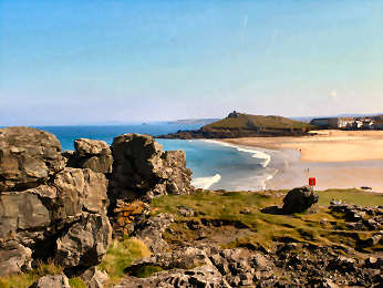
Stage 10 - Holywell Bay to St. Agnes, Trevaunance Cove - 12 miles
There is little difficult about this stage but tides may complicate matters. There are fine views, both along the coast, sometimes as far as St. Ives, and over superb beaches at Holywell Bay and at Perran Beach. All the way to Trevaunance Cove below St. Agnes village no part is more than moderate. Indeed, to Perranporth it is all distinctly easy. Leaving Holywell Bay, do look back over the superb sweep of the bay. And, once up to Penhale Point, the view ahead to St. Ives is grand. For much of the way from Holywell Bay to Perranporth freedom of movement is restricted by fences along the military land of Penhale Camp. After a steepish final descent to Perran Beach the official path goes along the beach to a path up towards Perran Sands holiday park. It then continues over the dunes of Perran Sands and Reen Sands to the beach at Perranporth. At low tide, you should be able to use the beach all the way to Perranporth. At very high tides, you may need to take an alternative, wholly inland route. See below for this. After Perranporth there are two moderate ascents, one out of Perranporth, one out of Trevellas Porth. Much of the way you are among, and walking on, mining spoil and at Hanover Cove there are vast quarrying remains. If staying in St. Agnes, it is a fair walk to the village from the coast path, with a steep climb up charming Stippy Stappy.
Millennium Sundial above Perranporth beach
Oliver's Diary - GPS Data, Useful Info, Interest
Stage 10 - Holywell Bay to St. Agnes, Trevaunance Cove -
At normal high tides, Perran Beach may not be completely passable. At very high spring tides, it could be necessary to avoid the beach entirely. In which case, you will need to follow a route which undulates between about 100 and 230 feet, adding around 300 feet to the total ascent but the distance is virtually identical. Just before Perran Beach at a WM post at 76462/57505 at 2.11 miles, the coast path goes R; ignore this and follow a green permissive path WM L to 76501/57362 at 2.20 miles at an MOD sign at a concrete track up into Penhale Camp training area. Cross the track and follow green permissive WMs on a clear path into Penhale Sands dunes, keeping R of the red and white poles. The path meanders and undulates, mostly through marram grass, to a fork (WM). Here fork R to a kissing gate at 76372/56440 at 2.82 miles. Continue down to 76380/56395 at 2.85 miles to cross a clear path up from Perran Beach. At 76388/56388 at 2.88 miles at 195 feet, at the main path up from Perran Beach, continue forward uphill on a sandy path. The route is now waymarked with yellow Coast Path WMs but is not always clear. That doesn’t matter since, as long as you stay roughly parallel to the beach, you will get there. In due course, you come to the concrete track down from Perran Sands holiday park and pass two paths down to the beach. When you reach the beach at Perranporth, by a Perran Sands storyboard, cross it to a wooden footbridge over a river, then cross another footbridge to the main beach car park. If the tide is exceptionally high, you might have to follow the dunes at the back of the beach to continue through the town.
Stage 10 - Holywell Bay to St. Agnes, Trevaunance Cove - Oliver's Diary
Walked solo in November 2009, I have always found this stage uninteresting. The fenced off land along Penhale Camp makes me feel a bit restricted but my spirits lift when I come to Perran Beach, more than two miles of extremely photogenic firm golden sand, walkable at most tides. This time I used the permissive path over the dunes here (see above) and, as I am interested in early Cornish Christian history, I made the detour to St. Piran’s Oratory, Church and Cross. Perranporth is a dire place but with some good value food; I particularly like the superb butcher’s pasties (right opposite the Tywarnhale Inn). I find much of the route, on mining spoil, from Perranporth to St. Agnes depressing; that view changes in later stages amongst engine houses and chimneys. However, in late summer and early autumn this part is blessed with a carpet of purple heather which relieves the tedium on the eye. Notable around here is the pair of coves at Hanover Cove where the cliff face has been deeply quarried and where the Hanover was wrecked in 1938 with �50m of gold on board. At Trevellas Porth the path heads inland a little way, through Blue Hills mine site. You may be tempted however, as I was, to cross the little bridge below the car park and scale the opposite hill to cut a corner. It is very steep, stony and slippery; definitely not for bad weather.
Description - GPS Data, Info, Interest The St. Piran Detour
Stage 10 - The St. Piran Detour - adds about 2� miles - well worth it!
Just before Perran Beach at WM post at 76462/57505 at 2.11 miles, coast path goes R, ignore it and follow a green permissive path WM L to 76501/57362 at 2.20 miles at a MOD sign at a concrete track into Penhale Camp training area, Perran Beach below to R. Cross track and follow green permissive WMs on a clear path into Penhale Sands dunes, keeping R of red and white poles. The path meanders and undulates, leaving marram grass into an open area. After marram grass begins again, at a fork (WM) go R to a kissing gate at 76372/56440 at 2.82 miles. Continue down to 76380/56395 at 2.85 miles, and cross a clear path up from Perran Beach. At 76376/56349 at 2.88 miles, go L on main path up from Perran Beach. Follow this uphill until modern ‘stone cross’ visible. Continue to stone cross and climb up to it. From here you can see storyboard by St. Piran’s Oratory. Head NNE to storyboard at 76874/56402 at 3.27 miles. Go L up to the Oratory at 76861/56406 at 3.28 miles. Now take a path uphill just N of E. At the top you can see St. Piran’s Cross. A path heads down SE to a wooden FB over a (probably) dry watercourse at 76988/56347 at 3.38 miles. Go roughly NE uphill until you see Church story board. Continue to the Church at 77197/56467 at 3.55 miles and St. Piran's Cross at 77222/56454. You can now either head right down to the beach or turn L at 76380/56395 to find a coast path WM and follow a dune route.
St. Piran's Cross on the dunes of Penhale Sands
Photo taken during 2007 dig, hence stones by the church site
ST PIRAN'S ORATORY: The information above about St.Piran's Oratory is now (2014) out of date. The oratory has been excavated and now stands exposed. So, from the stone cross, you will be loking down to the Oratory itself. Otherwise directions remain the same.
Stage 10 - Holywell Bay to St. Agnes, Trevaunance Cove -GPS Data
Distance: 11.88 miles. Cumulative: 101.26 miles. Intermediate: Perran Beach 2.17 miles, Perranporth 4.5 miles, Cligga Head 6.5 miles.
Ascent: Estimated 1250 feet. Cumulative: Estimated 19600 feet. Highest Point: After Pen a Grader, at grid ref: 732/526, 326 feet. Biggest climb: 257 feet up from Trevellas Porth. Also 200 feet up from Holywell Bay, 179 feet up from Perranporth. Steps: Up none. Down 120, longest flights 67 steps down to Trevellas Porth, 53 down to Trevaunance Cove. Stiles: None. Maps: OS Explorer 104 Redruth and St. Agnes. Difficulty: Moderate with a lot of easy once up on top and a possible 2.3 mile sandy beach walk along Perran Beach at lower tides.
Car Parking: Large NT CP Holywell Bay. CP Trevaunance Cove and top of town in St. Agnes. Intermediate Parking: Perranporth beach and Droskyn Field (free winter) on coast path S end of Perranporth. Transport: First Kernow bus 87 links Holywell Bay and Perranporth. Hopleys 315 links Perranporth & St Agnes. Refreshments: St. Piran’s Inn and Treguth Inn, Holywell Bay. Wide choice Perranporth. Pub and seasonal caf�s, Trevaunance Cove. Toilets: Holywell Bay, Perranporth and Trevaunance Cove. Accommodation: Holywell Bay, Perranporth, Trevaunance Cove, St. Agnes village (1 mile)
Penhale Camp: Military training area, not in much use these days. There is talk it may be closed and the area opened to the public. Rock Doors: On the way you will notice several doors, natural gaps in the lower part of projecting cliffs; one on Penhale Point, one in Hoblyn’s Cove, another at the southern end of Perran Beach. Not to be confused with man-made mine adits which occur along the coast. Towans: The Cornish word for sand dunes. You will already have encountered considerable stretches of towan along the Camel Estuary and at Holywell Bay. Those behind Perran Beach are extensive. There are more to come before Hayle. Perranporth: A fairly dire down-market holiday resort made bearable by the superb beach and by plenty of good value food. The Watering Place on the sand looks like a beach caf� but is more of a beer joint. Leaving Perranporth, stick to the clifftop to see the Millennium Sundial and a rock with a vast door in it. Trevellas Porth: Tin workings at Blue Hills Sett, above Trevellas Porth, have been restored. Once tin was mined in this valley; the mine closed in 1897 but the Wills family have continued tin streaming. A tour of the works demonstrates processes - panning, vanning and jigging.
St. Piran: Patron saint of Cornish tin miners, said to have arived from Ireland floating on a millstone. As well as his Oratory, Church and Cross on Penhale Sands, the name Piran (or Perran) also occurs at Rose, 1� mile SSE. This was an iron age farmstead, later used as a Plen-a-Gwary, a 'Playing Place' where religious plays were performed. And see feature above. St. Agnes: Once a busy mining village, went downhill badly when the mines closed, but now it is considerably revitalised, bright and colourful. Shops seem to flourish - local stores as well as art and craft galleries. For a small but seriously steep hill, walk up into St. Agnes from Trevaunance Cove. The route goes up almost vertiginous Stippy Stappy, a charming row of former miners cottages, now sadly second homes.
**************************************************************************************
Stage 11 - St. Agnes to Portreath - 8� miles
The statistics – 1600 feet of ascent with 267 steps up (with some high risers) and 278 steps down – suggest a relatively difficult stage. That isn’t borne out on the ground where it never really seems more than moderate. Perhaps that is because for much of the way you are up between 200 and 300 feet, undulating gently from one headland to another. This is the first stage that has substantial mine remains, including many capped mine shafts and a number of engine houses and chimneys. It also has another stretch of MOD property, the former Nancecuke weapons base, now known as Portreath Airfield. And, if you enjoy a colourful walk, try to do this in late summer or early autumn when the mass of heather is in bloom. The stage starts with a little road and lane but, after an initial steepish climb, is soon up on the heights where it remains before descending to the famous Towanroath engine house and Chapel Porth. A long climb follows up to Mulgram Hill (don’t try the path straight up the cliff) and again it is easy going along the top before the descent to Porthtowan. The last section, on to Portreath, includes a couple of steep parts. Shortly before Portreath a landslip has closed the path and you have to follow the road down to the village. There, just follow round the harbour as far as you can then go behind the Waterfront Inn to cross some sand to the beach car park.
Oliver's Diary - GPS Data, Useful Info, Interest
Stage 11 - St. Agnes to Porthreath - Oliver's Diary
I walked this stage with Bob on a sunny late November day. Sunny maybe but a wind in our faces, gusting to 50 mph, made 8� miles seem more like 12. A high sea was running, impressive waves crashing into the rocks below us, so we got some good surf photos. We enjoyed the intermittent long views, back to Penhale Point and Gull Rocks, forward to St. Ives. My particular enjoyment was the mining remains, now beginning to take a prominent place in the landscape with engine houses and chimneys here and there. On the way to Chapel Porth are some of my favourite remains, of Wheal Coates mine and of romantically situated Towanroath engine house below it. Chapel Porth makes a great seasonal watering-hole with its excellent caf�. Beyond Chapel Porth there are a couple of mine shafts with unusual square cappings. Near the second are remains of the wartime defences of Nancecuke about which rumours remain rife: was it really a chemical weapons dump? At Porthtowan look out for Blue; at Portreath, the greasy spoon between car park and beach is good value. If you have a spare half-day in St. Agnes, you may enjoy one of my earliest round walks. From Chapel Porth follow Chapel Combe inland till a path bears off left to climb St. Agnes Beacon (great views). Then drop down to Trevaunance Cove and follow the coast back to Chapel Porth. Click here for full details.
Description - GPS Data, Useful Info, Interest
Stage 11 - St. Agnes to Portreath - GPS Data
Distance: 8.57 miles. Cumulative: 109.83 miles. Intermediate: Chapel Porth 3.25 miles, Porthtowan 4.49 miles, Sally’s Bottom Footbridge 6.12 miles. Ascent: Estimated 1600 feet. Cumulative: Estimated 21200 feet. Highest Point: After Carn Gowla, 325 feet at grid ref: 698/511. Biggest climb: 282 feet up from Porthtowan. 271 feet up from Chapel Porth. 223 feet up from Trevaunance Cove. Steps: Up 267, longest flight 110 up from Trevaunance Cove. Down 278, longest 70 down before Portreath. Stiles: None. Maps: OS Explorer 104 Redruth and St. Agnes. Difficulty: Moderate with a lot of easy once up on top and just one steep descent and ascent.
Car Parking: Small CP at Trevaunance Cove also large CP in St. Agnes. Large CP above beach at Portreath. Intermediate Parking: NT Chapel Porth, large CP Porthtowan, parking by cliffs before Portreath. Transport: No known linking public transport. Refreshments: Driftwood Spars and seasonal caf� Trevaunance Cove; seasonal caf� Chapel Porth; Blue and several pubs and seasonal caf�s Porthtowan; greasy spoon above beach, pubs and caf�s Portreath. Toilets: Trevaunance Cove, Chapel Porth (seasonal), Porthtowan, Portreath. Accommodation: St. Agnes, Trevaunance Cove, Porthtowan, Portreath.
Bat Cones: Along the coast here you will see several inverted conical metal frames. These cap mineshafts and allow bats in and out. Wheal Coates: Major mine remains shortly before Chapel Porth. The impressive remains date mostly from the 1870s and include winding engine house, stamps engine house, arsenic calciner and, below on the Coast Path, Towanroath pumping engine house, probably the most photographed in Cornwall. Chapel Porth: A popular, if sometimes difficult, surfing cove. Its great attraction is as a seasonal watering-hole, the caf� does superb hot baguettes, fresh coffee and hedgehog ice cream – not real hedgehog but dressed a little like one. Porthtowan: A busy surf resort, its beach backed by small dunes. Porthtowan has several pubs and seasonal caf�s. Best refreshments here are at Blue (passed on the path) which is the parent of Falmouth’s defunct Blue South. Portreath: Now a very ordinary down-market little resort, blessed by a safe sandy family beach, in the 18th and 19th centuries it was an important port, a major player in the tin and copper trade, serving mines around Redruth and Camborne. An important tramway ran from Redruth and is now part of the Coast-to-Coast Mineral Tramways Trail. A steep inclined plane on the western side brought the Portreath Branchline of the Hayle Railway down to the port. The port declined in the 20th century and the harbour is now used by a small fishing fleet and pleasure boats. In World War II the military took over, clearing away warehouses, and the area served as a top secret airfield and weapons storage facility high on the east side at Nancekuke. The warehousing area now has late 20th century housing on it, most of it frankly quite unattractive, while chalets line the cliffs.
Mining Trails: Formerly known as the Mineral Tramways, many have been turned into multi-use trails, creating almost 40 miles of easy walking, cycling and horse riding. Linear Trails are the Coast-to-Coast, the Portreath Branchline, the Redruth and Chacewater, the Tehidy Trail and the Tresavean Trail. The Great Flat Lode is a circular trail around Carn Brea. A Tolgus Trail was planned but the money ran out too soon for it to be constructed. Coast-to-Coast Trail: Runs 12 miles from Portreath to Devoran on the south coast, through some mining countryside. Of all the mining trails, this is the busiest so, if walking it, avoid high summer. Portreath Branchline Trail: This runs from Portreath to Brea Village, where it links with the Great Flat Lode Trail. Sadly the Portreath Incline Plane was not able to be restored so the trail starts with a path up the wooded Feadon valley. The Tehidy Trail, not really a mining trail, leaves the Portreath Branchline and runs through Tehidy Park.
******************************************************************************************
Stage 12 - Portreath to Hayle - 11� miles
At the beginning, for the first mile-and-a-half, you feel that this is going to be a fairly tough stage. However, once on the downs after the Carvannel Valley, you soon discover that the rest of the route is very easy going. The only problem comes once you leave the main National Trust Godrevy car park for the chalet shanty town at Hayle (see below). From Portreath you start uphill on a tarmac lane but, after dropping down to some holiday homes at the western end of the beach, you are soon on open ground. After a kissing gate, waymarks offer a choice of routes up Western Hill, the right fork has 59 steep steps. It is then easy going to the Carvannel Valley where there are two steep descents and ascents, each with steps. You then stay up on the top at around 200 feet or so, all along Reskajeague Downs and North Cliffs, all the way to Hell’s Mouth where there is a handy seasonal caf�. The climbs up to Navax Point and Godrevy Point are both very easy and it is then a very gentle descent above surfing beaches to the main National Trust Godrevy car park. From here waymarks lead across the dunes to the harbourside at Hayle. Many may prefer to take to the moist sand here and follow the superb four mile arc of beach to Hayle. Views along the way are not extensive – back to Penhale Point, forward to St. Ives and later the hills of West Penwith – but are always pleasant.
The final section from Godrevy to Hayle - Dunes or Beach?
Surfers on Gwithian Beach, Godrevy Light behind
Oliver's Diary - GPS Data, Useful Information and Interest
Stage 12 - Portreath to Hayle - Godrevy to Hayle - Dunes or Beach?
From the main NT Godrevy car park follow the waymark down to the Red River. Once across the footbridge, slate waymarks (difficult to read) take you left and right and past former sand pits to start the trek across the dunes – Gwithian, Upton or Dynamite, Phillack, Mexico and Riviere Towans – to Hayle. Once on Gwithian Towans regular Coast Path waymarking is good and, initially, from each waymark you can see the next. Further on you need to continue a little way to spot the next waymark. Unfortunately, at about halfway, waymark posts peter out sometimes. You should be OK if you keep to a rough south-west heading and keep away from the cliffs and the high dunes further inland. At the Hayle end, on Riviere Towans, is an entertaining shanty town of privately owned holiday chalets. If you prefer to take the beach route you will have no trouble at low tides. If the tide comes in you can head up onto the dunes at several points – look out for the lifeguard huts – and at high tide you will certainly not get round Black Cliff at the Hayle end of the beach.
Along the way
This account was written by Oliver Howes and is reproduced here in his own words, preserved in his memory.