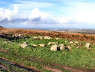
Carn Brea - the hill overlooking Camborne and Redruth
This impressive hill, a ridge a mile long, towers over Camborne and Redruth. Views are superb but mostly to the north. The visible archaeoloogy is something of a disappointment. An important neolithic settlement of the early 4th millennium BC had an 8 acre enclosure surrounded by an 11 acre enclosure, occupied by a hundred or so people. Later, iron age occupants streamed for minerals and traded as far as Kent. In medieval times stone was quarried and the Bassetts hunted from their 'castle' hunting lodge, Carn Brea Castle. Most prominent feature of the hill is the great monument commemorating Francis Bassett, Lord de Dunstanville, a major mine owner. The hill is much overgrown with furze, brambles and bracken and all I have been able to find are a couple of standing stones, some boundary stones and two hut circles. Perhaps a serious heath fire might expose what the experts found in the 1970s. Although, when visiting Carn Brea, which I have done many times, I prefer to walk, making a variation to the Great Flat Lode Trail, you can drive to the top of the hill. A track leads up from Carnkie village and you can park not far from Carn Brea Castle. Carn Brea should not be confused with Chapel Carn Brea, with its vast cairn, which is not far from St. Just-in-Penwith.
Carn Brea, hut circle on the northern edge
A Carn Brea figure-of-eight walk
More in Antiquities
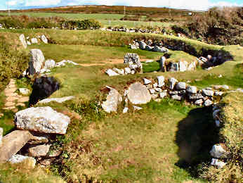
Carn Euny Iron Age Village
Euny Iron Age Village
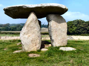
Carwynnen Quoit - or the Giant's Quoit
I first encountered this site when walking the Land's End Trail in an east to west direction in 2007. Carwynnen Quoit, also known as the Giant's Quoit or Devil's Frying Pan, was, when I first saw it, a totally collapsed neolithic burial chamber. To look at it then you might have wondered if it were not just a heap of rocks but there was an image of it still standing in The Modern Antiquarian. Apparently it was re-erected in the mid 20th century, only to collapse again in 1983. Now (2014) it has been re-erected by the Sustainable Trust which acuired the site in 2009. Fund-raising and acquiring the co-operation of official bodies enabled re-erection in 2014. Carwynnen Quoit is not entirely easy to find. You need to get to the tiny settlement of Carwynnen - where you can probably park - take the hill up towards Troon and go through a gate on the left. Just inside the field is an informative storyboard. When I re-visited in September 2014 I chose an alternative route. I parked in fascinating Treslothan villlage - well worth a visit in its own right - and walked through fields and woods to the road from Troon to Carwynnen, turning right to find the site. The Sustainable Trust has made a great job of restoration - though it will be some time before the now clean stones settle back into the landscape.
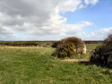
Castallack Round
When I walked here with my sister Mary in March 2008, on my first stage of the Penwith Round, I was sufficiently puzzled by what OS102 clearly shows as Castallack Round that I returned a few days later to take another closer look. The Penwith Round route instructions are, I think, misleading, suggesting you turn right (north) on a grassy path. There is no grassy path and the entrance is before the track becomes a path and just before a wooden gate. Before I returned, I checked the usual sources (The Modern Antiquarian and Megalithic Portal) and found nothing useful. What I found on site was a large level field, a little higher than the land to its north, surrounded by a massive hexagonal wall. The image on the right shows what may have been the entrance. The site was definitely made by early man, presumably for occupation since the site was levelled. The name is confirmation, the Cornish Castallek meaning 'fortified' according to Craig Weatherhill. The wall, much degraded, stands about seven feet high in places and as much as six feet thick. Since there is supposed to be a Bronze Age hut circle in one corner - I couldn't find it - perhaps the site is of that period. What it certainly isn't is a conventional Cornish round; you only have to look at Piran or Pencarrow Rounds to see the total difference. A puzzling and fascinating site.